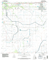
1994 Map of Iowa
USGS Topo · Published 1996About this map
The Iowa Oil and Gas Field and Holmwood Oil and Gas Field define the economic landscape of this Calcasieu Parish region in the mid-1990s. The terrain is deeply shaped by hydraulic management, featuring the Government Ditch, Indian Bayou Canal, and an extensive levee system that protects low-lying agricultural and industrial lands.
Find a feature on this map
23 named features on this map. Tap any name to fly to it.
Don’t see what you’re looking for? This feature index may not catch every label — zoom into the map to look around manually.
Map Details
Editions of this 1994 Iowa Map
This is the sole edition of this map. No revisions or reprints were ever made.
Other maps of this area

1932 · Lake Charles NE
USGS Topo · 1:31,680

1932 · Lake Charles NW
USGS Topo · 1:31,680

1932 · Lake Charles SW
USGS Topo · 1:31,680

1932 · Lake Charles SE
USGS Topo · 1:31,680

1935 · Moss Bluff
USGS Topo · 1:31,680

1942 · Lake Charles
USGS Topo · 1:62,500

1946 · Lacassine
USGS Topo · 1:31,680

1946 · Hayes
USGS Topo · 1:31,680

1947 · Fenton
USGS Topo · 1:31,680

1947 · Moss Bluff
USGS Topo · 1:31,680