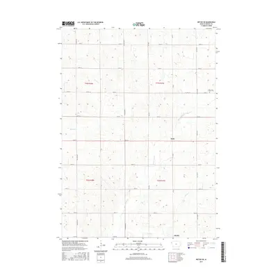
2015 Map of Ireton SW
USGS Topo · Published 2015About this map
Ruble and Adaville anchor this survey of the agrarian landscape in western Iowa. The terrain is defined by a series of drainage networks, most notably the winding path of Broken Kettle Cr and its tributary Bull Run, which carve through the undulating topography. In the northeast, the Saint Johns Lutheran Cem stands as a focal point for local genealogical interest, positioned near the junction of 150th St and Granite Ave. The map illustrates a highly organized section-line road system, including Co Hwy C16 and Co Rd C38, which facilitates the region's agricultural transport. Other watercourses like Beaver Cr and Westfield Cr further detail the hydrological character of Plymouth County, showing how the land was partitioned and settled around these natural water sources.
Find a feature on this map
27 named features on this map. Tap any name to fly to it.
Don’t see what you’re looking for? This feature index may not catch every label — zoom into the map to look around manually.
Map Details
Editions of this 2015 Ireton SW Map
This is the sole edition of this map. No revisions or reprints were ever made.
Other maps of this area

1898 · Elk Point
USGS Topo · 1:125,000

1901 · Elk Point
USGS Topo · 1:125,000

1907 · Elk Point
USGS Topo · 1:125,000

1955 · Sioux City
USGS Topo · 1:250,000

1958 · Sioux City
USGS Topo · 1:250,000

1959 · Sioux City
USGS Topo · 1:250,000

1963 · Elk Point NE
USGS Topo · 1:24,000

1964 · Hinton
USGS Topo · 1:24,000
1964 · Millnerville
USGS Topo · 1:24,000
1969 · Chatsworth
USGS Topo · 1:24,000