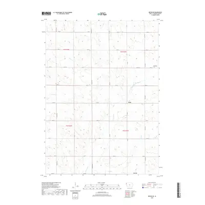
2018 Map of Ireton SW
USGS Topo · Published 2018About this map
Ruble and Adaville anchor this portion of Plymouth County, illustrating the persistent agricultural grid of northwest Iowa. The landscape is defined by the winding paths of Broken Kettle Cr and Bull Run, which carve through the undulating terrain otherwise dominated by straight section roads like 180th St and Evergreen Ave. This 2018 survey provides a clear view of local heritage sites, most notably the Saint Johns Lutheran Cem located along 150th St near the eastern edge. Smaller watercourses like Westfield Cr and Beaver Cr drain the northwestern sections, showing how the natural hydrology interacts with the established township lines of t93n r48w and t92n r47w. The map serves as a precise record of rural community centers and family-farm access routes in the early 21st century.
Find a feature on this map
28 named features on this map. Tap any name to fly to it.
Don’t see what you’re looking for? This feature index may not catch every label — zoom into the map to look around manually.
Map Details
Editions of this 2018 Ireton SW Map
This is the sole edition of this map. No revisions or reprints were ever made.
Other maps of this area
1898 · Elk Point
USGS Topo · 1:125,000
1901 · Elk Point
USGS Topo · 1:125,000
1907 · Elk Point
USGS Topo · 1:125,000
1955 · Sioux City
USGS Topo · 1:250,000
1958 · Sioux City
USGS Topo · 1:250,000
1959 · Sioux City
USGS Topo · 1:250,000
1963 · Elk Point NE
USGS Topo · 1:24,000
1964 · Hinton
USGS Topo · 1:24,000
1964 · Millnerville
USGS Topo · 1:24,000
1969 · Chatsworth
USGS Topo · 1:24,000