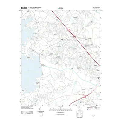
2011 Map of Irmo
USGS Topo · Published 2011About this map
Lake Murray dominates the western landscape of this Richland County survey, its jagged shoreline giving rise to numerous residential developments such as Yacht Cove, Selwood Shores, and Ballentine Landing. The massive Saluda Dam stands as the primary engineering feature controlling the waters of the Saluda River, which flows eastward toward its confluence with the Broad River near the map's edge. The town of Irmo serves as a central hub, situated along the corridor of I-26, reflecting the suburban expansion of the Columbia area in the early 21st century.
Find a feature on this map
73 named features on this map. Tap any name to fly to it.
Don’t see what you’re looking for? This feature index may not catch every label — zoom into the map to look around manually.
Map Details
Editions of this 2011 Irmo Map
This is the sole edition of this map. No revisions or reprints were ever made.
Other maps of this area

1904 · Columbia
USGS Topo · 1:125,000

1941 · Spartanburg
USGS Topo · 1:250,000

1944 · Gilbert
USGS Topo · 1:62,500

1944 · Edmund
USGS Topo · 1:62,500

1946 · Irmo
USGS Topo · 1:24,000

1947 · Columbia North
USGS Topo · 1:24,000

1947 · Richtex
USGS Topo · 1:24,000

1948 · Irmo
USGS Topo · 1:24,000

1948 · Columbia North
USGS Topo · 1:24,000

1949 · Richtex
USGS Topo · 1:24,000