Old Maps of Lexington County, South Carolina
Explore 166 old maps of Lexington County, spanning from 1904 to today. These high-resolution historic maps reveal how streets, neighborhoods, landmarks, and natural features evolved over time — perfect for genealogy, metal detecting, research, and local history exploration.
What you can do with these maps:
- See how Lexington County changed over time: Compare historical maps to modern-day views to trace roads, homesites, rail lines & more.
- View detailed metadata: Each map includes creators, publishers, year, scale, and archive source.
- Overlay maps with satellite & LiDAR: Visualize the past alongside modern tools to explore terrain & human change.
- Trusted historical sources: Maps sourced from the USGS, Library of Congress, and other archives.
- Access maps your way: View online, download high-res files, or order prints for personal or research use.
Start exploring old maps of Lexington County to uncover forgotten places, hidden landmarks, and the deep history beneath your feet.
Lexington County, SC maps
(166)- 1904 Map of Columbia
 1904 Columbia1904 Print · USGSRichland and Fairfield counties at the turn of the century are defined by their river-and-rail corridors and rural church communities. Genealogists can trace family footprints across Broad River ferries, the Southern R.R., and landmarks like The Old Brick Church or Winnsboro.2 unique versions available
 - 1941 Map of Spartanburg
 1941 Spartanburg1941 Print · USGSSouth Carolina’s Piedmont and Sandhills regions are shown here during the mid-century peak of the rail era. Researchers can trace the sprawling Fort Jackson Military Reservation and the industrial growth of hubs like Spartanburg and Rock Hill.
 - 1944 Map of Gilbert, 1946 Print
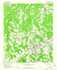
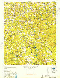 1944 Gilbert1946 Print · USGSMid-century Lexington County is mapped here as a network of rail-side towns and rural mill seats. Researchers can trace family roots at St Matthews Ch, locate the Saxe-Gotha Millpond, or follow the Southern Railway through Gilbert.2 unique versions available
 - 1944 Map of Seivern, 1946 Print
 1944 Seivern1946 Print · USGSAiken County during the mid-1940s shows a landscape of river-fed millponds and historic trade routes. Genealogists can trace rural communities through landmarks like the Springfield Rosenwald Sch, Kitchings Mill, and the Ninety-Six Indian Trail.2 unique versions available
 - 1944 Map of Edmund, 1966 Print
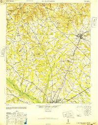
 1944 Edmund1966 Print · USGSLexington County and the southern fringes of Columbia are shown in detail during the final years of World War II. Researchers can locate family landmarks like Saxe Gotha Sch, the Columbia Air Base, and Huckabaas Millpond.
 - 1946 Map of Woodford
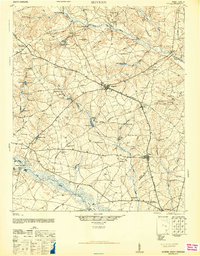
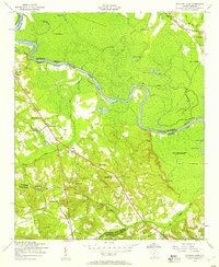
 1946 Woodford1946 Print · USGSThe mid-century rural landscape of Orangeburg and Lexington Counties is captured here as the Edisto River basin supported a network of small mill towns. Genealogists can trace family connections to numerous local landmarks like Kings Grove Ch, Darian Sch, and Pooles Millpond.3 unique versions available
 - 1946 Map of St. Matthews
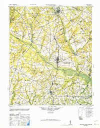
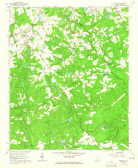
 1946 St. Matthews1946 Print · USGSSouth Carolina’s agricultural heartland is documented here in the mid-forties as the rail lines connected rural crossroads to the county seat. Genealogists can trace family landmarks and community centers like Bethlehem Church, Hammond Crossroads, and the historic Old Ninety-Six Road.2 unique versions available
 - 1946 Map of Irmo, 1968 Print
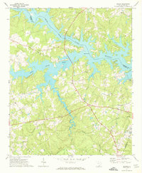
 1946 Irmo1968 Print · USGSMid-century Richland and Lexington Counties are caught in transition as the hydroelectric power of the Saluda River reshapes the land. Researchers can trace rural school locations like Rosenwald Sch and historical churches such as St Andrews Ch or Pilgrim Ch.
 - 1947 Map of Columbia North, 1965 Print
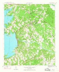
 1947 Columbia North1965 Print · USGSColumbia and its northern suburbs are captured in detail just after the war, showing the capital's rapid expansion into Eau Claire and Arden. Local historians can trace institutional history through the State Hospital, Allen Univ, and the State Penitentiary along the Broad River.
 - 1948 Map of Hopkins
 1948 Hopkins1948 Print · USGSRichland and Calhoun counties are captured here just after the war, showing the expansion of federal military sites into the rural South Carolina landscape. Genealogists can locate family-named landmarks like Coughmans Pond and dozens of country schools including Lower Richland High Sch and Hopkins Sch.3 unique versions available
 - 1948 Map of Irmo
 1948 Irmo1948 Print · USGSThe Irmo area of South Carolina thrived as a railway and agricultural hub in the mid-forties, just as the Saluda River's transformation was complete. Genealogists and historians can trace institutional roots at the Harbison Institute or locate family plots at Upper Pine Grove Cem and Lower Pine Grove Cem.2 unique versions available
 - 1948 Map of Columbia North
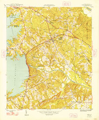
 1948 Columbia North1948 Print · USGSColumbia and its northern suburbs are documented in the late 1940s as the city expanded across the Congaree and Broad River forks. Genealogists can trace family landmarks and historical sites including the Soldiers Home, Slatestone Graveyard Hill Cem, and Benedict College.2 unique versions available
 - 1953 Map of Saylors Lake, 1957 Print
 1953 Saylors Lake1957 Print · USGSThe Congaree River bottomlands and Calhoun County hills are captured here in the early fifties, showing a rural landscape of family cemeteries and country churches. Genealogists can trace sites like Kaigler Cemetery, Heyward School, and Sandy Run Church.
 - 1953 Map of Spartanburg, 1966 Print
 1953 Spartanburg1966 Print · USGSMid-century South Carolina comes into focus through this survey of the Piedmont and the Sand Hills at a time of significant reservoir expansion. Researchers can trace the legacy of industrial transit and resource extraction from the Haile Gold Mine to the rail hubs of the Seaboard Air Line.4 unique versions available
 - 1954 Map of Augusta
 1954 Augusta1954 Print · USGSThe Savannah River valley and South Carolina Midlands are captured here during a period of post-war growth. Researchers can trace the rail-and-river economy through the Southern RR corridor and locate historic settlements like Aiken, Orangeburg, and Sumter.
 - 1957 Map of Augusta, 1966 Print
 1957 Augusta1966 Print · USGSThe Savannah River and Santee basins are captured here during a period of massive military and industrial expansion in the late fifties. Genealogists can trace family footprints across Four Hole Swamp or near the Savannah River Plant.3 unique versions available
 - 1958 Map of Augusta
 1958 Augusta1958 Print · USGSThe borderlands between Georgia and South Carolina come alive in the 1950s, showing the early footprint of the Savannah River Plant. Genealogists and historians can trace rail-dependent towns and rural landmarks from Orangeburg to the Fort Jackson Military Reservation.
 - 1960 Map of Spartanburg
 1960 Spartanburg1960 Print · USGSThe South Carolina Piedmont and North Carolina borderlands come alive in this mid-century survey of the region between Spartanburg and Columbia. Researchers can trace the Seaboard Air Line railroad and explore landmarks like Anderson Quarry, Lake Murray, and Mount Croghan.2 unique versions available
 - 1961 Map of Augusta
 1961 Augusta1961 Print · USGSThe South Carolina lowcountry and CSRA appear here in the early sixties, during a period of massive military and industrial growth. Researchers can trace the development of the Savannah River Plant or locate legacy landmarks like Nelson Ferry and Magnolia Cemetery.2 unique versions available
 - 1962 Map of Augusta
 1962 Augusta1962 Print · USGSThe South Carolina and Georgia borderlands are seen here in the early sixties, showing the rise of the Savannah River Plant and the expansion of Fort Jackson. Researchers can trace old rail lines like the Southern Railway and find landmarks such as St. Pauls Church or the Santee Canal.
 - 1963 Map of Spartanburg
 1963 Spartanburg1963 Print · USGSMid-century South Carolina comes alive in this survey, showing the rail-linked corridor between the Upstate and the Midlands. Genealogists can trace family lands near old hubs like Union and Lancaster, or along the banks of the Broad River and Pee Dee River.
 - 1964 Map of Spartanburg
 1964 Spartanburg1964 Print · USGSMid-century South Carolina comes alive in this survey of the Piedmont and Upcountry, stretching from the Blue Ridge foothills to the Sandhills. Genealogists and historians can trace the rail-and-river economy through Monarch Mills, Glenn Springs, and the Southern Railway corridor.
 - 1964 Map of Monetta, 1965 Print
 1964 Monetta1965 Print · USGSMonetta and its surrounding farmsteads are captured in the mid-sixties at the junction of three South Carolina counties. Researchers can trace old family lines through Monetta Cemetery and the Kneece settlement, or locate mid-century landmarks like the Drive-in Theater.2 unique versions available
 - 1964 Map of Batesburg, 1965 Print
 1964 Batesburg1965 Print · USGSBatesburg and Leesville are shown in detail during the early 1960s as they prospered along the Southern Railway corridor. Genealogists can trace countless family sites like Mitchell Cem, Bouknight Cem, and rural landmarks such as Holston Crossroads.2 unique versions available
 - 1970 Map of Delmar, 1973 Print
 1970 Delmar1973 Print · USGSSaluda and Newberry Counties center on the expansive shoreline of the Saluda River Lake Murray reservoir in the early seventies. Genealogists and local historians can trace family locations near landmarks like Delmar, Utopia Sch, and the St Marks Ch churchyard.
Showing maps 1-25 of 166
Top cities of Lexington County
- Lexington historical maps
- West Columbia historical maps
- Cayce historical maps
- Springdale historical maps
- South Congaree historical maps
- Pine Ridge historical maps
See more
Frequently asked questions
- What are the different types of historical maps available for Lexington County?
- What is the oldest map of Lexington County?
- Where can I purchase historical maps of Lexington County for my home or office?
- Where can I download high-res historical maps of Lexington County?
- Are there historical topographic maps available for Lexington County?
- Is there historical aerial imagery available for Lexington County?
- Where are historical maps of Lexington County sourced from?