Old Maps of Lexington County, South Carolina for Hiking & Exploration
Hike through history with 74 historic maps of Lexington County. Explore old trails, ghost towns, and forgotten backroads — perfect for outdoor adventurers and local explorers.
- Rediscover forgotten places: Map out old mining camps, roads, and footpaths that no longer exist on modern maps.
- Layer with modern tools: Combine with LiDAR or satellite views to plan hikes through historical terrain.
- Made for exploration: Popular among hikers, overlanders, and local history lovers.
Use these maps to find adventure and explore the hidden past of Lexington County.
Lexington County, SC maps
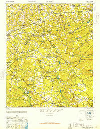
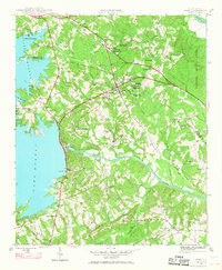
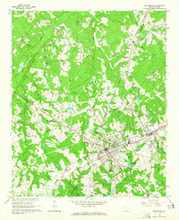
(74)- 1904 Map of Columbia
 1904 Columbia1904 Print · USGSCovers Lexington County, including Columbia, Lexington, and other nearby areas2 unique versions available
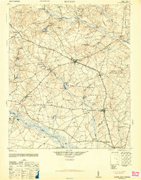
 - 1941 Map of Spartanburg
 1941 Spartanburg1941 Print · USGSCovers Lexington County, including Columbia, Rock Hill, and other nearby areas
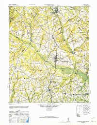
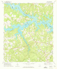
 - 1944 Map of Gilbert, 1946 Print
 1944 Gilbert1946 Print · USGSCovers Lexington County, including Lexington, Pelion, and other nearby areas2 unique versions available
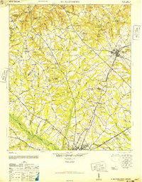
 - 1944 Map of Seivern, 1946 Print
 1944 Seivern1946 Print · USGSCovers Lexington County, including Wagener, Springfield, and other nearby areas2 unique versions available
 - 1944 Map of Edmund, 1966 Print
 1944 Edmund1966 Print · USGSCovers Lexington County, including Columbia, Lexington, and other nearby areas
 - 1946 Map of Woodford
 1946 Woodford1946 Print · USGSCovers Lexington County, including Swansea, Pelion, and other nearby areas3 unique versions available
 - 1946 Map of St. Matthews
 1946 St. Matthews1946 Print · USGSCovers Lexington County, including Orangeburg, Saint Matthews, and other nearby areas2 unique versions available
 - 1946 Map of Irmo, 1968 Print
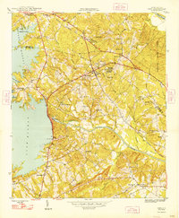
 1946 Irmo1968 Print · USGSCovers Lexington County, including Columbia, Lexington, and other nearby areas
 - 1947 Map of Columbia North, 1965 Print
 1947 Columbia North1965 Print · USGSCovers Lexington County, including Columbia, West Columbia, and other nearby areas
 - 1948 Map of Hopkins
 1948 Hopkins1948 Print · USGSCovers Lexington County, including Columbia, Bruner, and other nearby areas3 unique versions available
 - 1948 Map of Irmo
 1948 Irmo1948 Print · USGSCovers Lexington County, including Columbia, Lexington, and other nearby areas2 unique versions available
 - 1948 Map of Columbia North
 1948 Columbia North1948 Print · USGSCovers Lexington County, including Columbia, West Columbia, and other nearby areas2 unique versions available
 - 1953 Map of Saylors Lake, 1957 Print
 1953 Saylors Lake1957 Print · USGSCovers Lexington County, including Sandy Run, Oak Grove, and other nearby areas
 - 1953 Map of Spartanburg, 1966 Print
 1953 Spartanburg1966 Print · USGSCovers Lexington County, including Columbia, Rock Hill, and other nearby areas4 unique versions available
 - 1954 Map of Augusta
 1954 Augusta1954 Print · USGSCovers Lexington County, including Augusta, Columbia, and other nearby areas
 - 1957 Map of Augusta, 1966 Print
 1957 Augusta1966 Print · USGSCovers Lexington County, including Augusta, Columbia, and other nearby areas3 unique versions available
 - 1958 Map of Augusta
 1958 Augusta1958 Print · USGSCovers Lexington County, including Augusta, Columbia, and other nearby areas
 - 1960 Map of Spartanburg
 1960 Spartanburg1960 Print · USGSCovers Lexington County, including Columbia, Rock Hill, and other nearby areas2 unique versions available
 - 1961 Map of Augusta
 1961 Augusta1961 Print · USGSCovers Lexington County, including Augusta, Columbia, and other nearby areas2 unique versions available
 - 1962 Map of Augusta
 1962 Augusta1962 Print · USGSCovers Lexington County, including Augusta, Columbia, and other nearby areas
 - 1963 Map of Spartanburg
 1963 Spartanburg1963 Print · USGSCovers Lexington County, including Columbia, Rock Hill, and other nearby areas
 - 1964 Map of Spartanburg
 1964 Spartanburg1964 Print · USGSCovers Lexington County, including Columbia, Rock Hill, and other nearby areas
 - 1964 Map of Monetta, 1965 Print
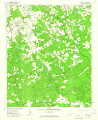 1964 Monetta1965 Print · USGSCovers Lexington County, including Chinquapin Falls, Jones Crossroads, and other nearby areas2 unique versions available
 - 1964 Map of Batesburg, 1965 Print
 1964 Batesburg1965 Print · USGSCovers Lexington County, including Hibernia, Holston Crossroads, and other nearby areas2 unique versions available
 - 1970 Map of Delmar, 1973 Print
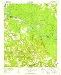
 1970 Delmar1973 Print · USGSCovers Lexington County, including Wyses Ferry, Saluda County, and other nearby areas
Showing maps 1-25 of 74
Top cities of Lexington County
- Lexington historical maps
- West Columbia historical maps
- Cayce historical maps
- Springdale historical maps
- South Congaree historical maps
- Pine Ridge historical maps
See more
Frequently asked questions
- What are the different types of historical maps available for Lexington County?
- What is the oldest map of Lexington County?
- Where can I purchase historical maps of Lexington County for my home or office?
- Where can I download high-res historical maps of Lexington County?
- Are there historical topographic maps available for Lexington County?
- Is there historical aerial imagery available for Lexington County?
- Where are historical maps of Lexington County sourced from?