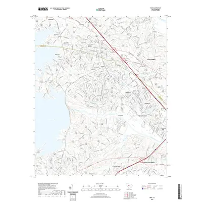
2020 Map of Irmo
USGS Topo · Published 2020About this map
Lake Murray dominates the western landscape of this survey, where the irregular shoreline of Rocky Point meets the waters formed by the damming of the Saluda River. To the east, the Broad River flows toward the capital, framing a region of significant suburban expansion and residential development. The town of Irmo serves as a central hub, flanked by growing communities such as Whitehall, Seven Oaks, and Challedon. This era of the late 2010s shows a dense network of roads like Broad River Rd and Dreher Shoals Rd interlaced with older landmarks. Genealogists can identify numerous local burial grounds, including Upper Pine Grove Cem and Lower Pine Grove Cem, which remain as markers of the area's earlier rural character. The CSX Transportation line cuts through the heart of the region, tracing the historic rail corridor that once linked these upstate settlements.
Find a feature on this map
315 named features on this map. Tap any name to fly to it.
Don’t see what you’re looking for? This feature index may not catch every label — zoom into the map to look around manually.
Map Details
Editions of this 2020 Irmo Map
This is the sole edition of this map. No revisions or reprints were ever made.
Other maps of this area

1904 · Columbia
USGS Topo · 1:125,000

1941 · Spartanburg
USGS Topo · 1:250,000

1944 · Gilbert
USGS Topo · 1:62,500

1944 · Edmund
USGS Topo · 1:62,500

1946 · Irmo
USGS Topo · 1:24,000

1947 · Columbia North
USGS Topo · 1:24,000

1947 · Richtex
USGS Topo · 1:24,000

1948 · Irmo
USGS Topo · 1:24,000

1948 · Columbia North
USGS Topo · 1:24,000

1949 · Richtex
USGS Topo · 1:24,000