
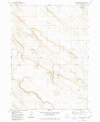
1980 Map of Iron Mtn. Flat
USGS Topo · Published 1980About this map
Iron Mountain rises as the dominant landmark in this high desert landscape of central Oregon, surveyed during the early 1970s. The map reveals an arid environment defined by seasonal water sources and expansive dry basins like Silver Lake and the vast Alkali Flat. Human activity in the region is marked primarily by sparse ranching infrastructure and land management, with numerous cattle-related water points such as Lakebed Waterhole and Dead Bull Waterhole scattered across the sagebrush-covered flats. The northeastern corner contains a portion of the Malheur Nat Wildlife Refuge, indicating the area's significance for migratory birds and conservation. A network of primitive transit routes, including the Stick Road and various jeep trails, provides access to isolated features like Hughet Lake and Glenns Hole, reflecting the remote and utilitarian nature of the Harney County interior during this era.
Find a feature on this map
33 named features on this map. Tap any name to fly to it.
Don’t see what you’re looking for? This feature index may not catch every label — zoom into the map to look around manually.
Map Details
Editions of this 1980 Iron Mtn. Flat Map
This is the sole edition of this map. No revisions or reprints were ever made.
Other maps of this area

1955 · Burns
USGS Topo · 1:250,000

1958 · Burns
USGS Topo · 1:250,000

1959 · Burns
USGS Topo · 1:250,000

1979 · Moon Reservoir
USGS Topo · 1:24,000

1980 · Capehart Lake
USGS Topo · 1:24,000
1980 · Hughet Spring
USGS Topo · 1:24,000

1980 · Lunch Lake
USGS Topo · 1:24,000

1980 · Stinking Lake
USGS Topo · 1:24,000

1980 · Lake on The Trail
USGS Topo · 1:24,000

1980 · Palomino Buttes
USGS Topo · 1:24,000