
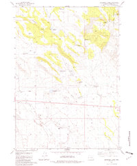
1979 Map of Moon Reservoir
USGS Topo · Published 1980About this map
Moon Reservoir and its associated Moon Dam anchor this high-desert water system in Harney County, documented during the late 1970s. The landscape is defined by the broad Silver Creek Valley, where Silver Creek flows through a series of natural and man-made basins. Notable water features such as Dusenberry Lake, Carvie Reservoir, and Antelope Reservoir indicate a highly managed hydraulic environment essential for local land use.
Find a feature on this map
20 named features on this map. Tap any name to fly to it.
Don’t see what you’re looking for? This feature index may not catch every label — zoom into the map to look around manually.
Map Details
Editions of this 1979 Moon Reservoir Map
This is the sole edition of this map. No revisions or reprints were ever made.
Other maps of this area

1955 · Burns
USGS Topo · 1:250,000

1958 · Burns
USGS Topo · 1:250,000

1959 · Burns
USGS Topo · 1:250,000

1980 · Capehart Lake
USGS Topo · 1:24,000

1980 · Iron Mtn. Flat
USGS Topo · 1:24,000

1980 · Stinking Lake
USGS Topo · 1:24,000

1980 · Lake on The Trail
USGS Topo · 1:24,000

1980 · Palomino Buttes
USGS Topo · 1:24,000

1981 · Sage Hen Hill
USGS Topo · 1:24,000
1981 · Oakerman Lakes
USGS Topo · 1:24,000