
1980 Map of Capehart Lake
USGS Topo · Published 1980About this map
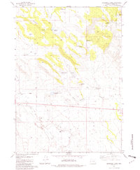
Capehart Lake and a high-desert network of seasonal waters dominate this Harney County landscape during the late 1970s. The terrain is defined by volcanic and basaltic features, such as the prominent Lookout Butte and the long expanse of Coyote Rim to the east. The map reveals a land utilized for water management and navigation, where Kellogg Waterhole and numerous small basins like Kidney Lake and Bone Lake provided vital resources in an arid environment. A single Jeep Trail cuts diagonally across the plateau, connecting these isolated water points. On the northern edge, Juniper Ridge rises above Porcupine Lake, while a solitary Borrow Pit suggests localized industrial activity or road maintenance near Squaw Lake. The nomenclature often reflects the wildlife and geography of the High Desert, from Buzzard Lake to the uniquely named Blowhole Lake.
Find a feature on this map
17 named features on this map. Tap any name to fly to it.
Don’t see what you’re looking for? This feature index may not catch every label — zoom into the map to look around manually.
Map Details
Editions of this 1980 Capehart Lake Map
This is the sole edition of this map. No revisions or reprints were ever made.
Other maps of this area

1955 · Burns
USGS Topo · 1:250,000

1958 · Burns
USGS Topo · 1:250,000

1959 · Burns
USGS Topo · 1:250,000

1979 · Moon Reservoir
USGS Topo · 1:24,000

1980 · Squaw Butte
USGS Topo · 1:24,000

1980 · Iron Mtn. Flat
USGS Topo · 1:24,000

1980 · Alec Butte
USGS Topo · 1:24,000

1980 · Lake on The Trail
USGS Topo · 1:24,000
1981 · Oakerman Lakes
USGS Topo · 1:24,000
1981 · Suntex
USGS Topo · 1:24,000