
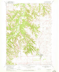
1969 Map of Iron Shell Flat East
USGS Topo · Published 1971About this map
Sacred Heart Ch and the Peyote Cem stand at the northwestern edge of this landscape, which lies entirely within the Rosebud Indian Reservation. The terrain is defined by the high, level plateau of Iron Shell Flat and the intricate drainage networks that carve into it. Watercourses like Cut Meat Creek and White Horse Creek create a complex topography of ridges and draws, eventually leading toward the Little Crazy Horse River Canyon in the southeast. A notable landmark in the river valley is the Valandra Bridge, a critical crossing point for the local road network during the late 1960s. The map also meticulously documents land use of the era, using fine dashed lines to indicate selected fence and field lines visible from aerial photography, reflecting the agricultural and ranching patterns of the Todd County region.
Find a feature on this map
11 named features on this map. Tap any name to fly to it.
Don’t see what you’re looking for? This feature index may not catch every label — zoom into the map to look around manually.
Map Details
Editions of this 1969 Iron Shell Flat East Map
This is the sole edition of this map. No revisions or reprints were ever made.
Other maps of this area

1955 · Martin
USGS Topo · 1:250,000

1958 · Martin
USGS Topo · 1:250,000

1969 · Eagle Mans Butte
USGS Topo · 1:24,000

1969 · Soldier Creek
USGS Topo · 1:24,000

1969 · Parmelee
USGS Topo · 1:24,000

1969 · Spring Creek SW
USGS Topo · 1:24,000

1969 · Iron Shell Flat West
USGS Topo · 1:24,000

1969 · Spring Creek
USGS Topo · 1:24,000

1969 · St. Francis SW
USGS Topo · 1:24,000
1969 · St. Francis
USGS Topo · 1:24,000
Featured Places
- Spring Creek, Spring Creek Segment
- Grass Mountain Segment, SD
- Spring Creek Segment, SD
- He Dog, SD
- Upper Cut Meat Segment, SD