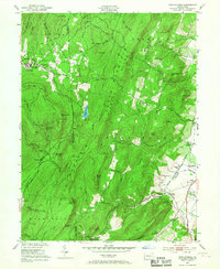
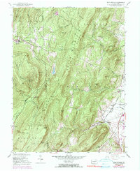
1953 Map of Iron Springs
USGS Topo · Published 1967About this map
The South Mountain Sanatorium sits atop the high ground of the South Mountain range, marking a significant early 20th-century institutional presence in this landscape. Below the ridges, the Western Maryland railroad follows the contours of the valley, connecting the industrial site at Maria Furnace with the community of Iron Springs. The map reveals a transition from the steep, wooded terrain of Culp Ridge and Snaggy Ridge to the agricultural openings around Fairfield and Virginia Mills.
Find a feature on this map
62 named features on this map. Tap any name to fly to it.
Don’t see what you’re looking for? This feature index may not catch every label — zoom into the map to look around manually.
Map Details
Editions of this 1953 Iron Springs Map
5 editions found
Other maps of this area

1902 · Chambersburg
USGS Topo · 1:62,500

1909 · Fairfield
USGS Topo · 1:62,500

1909 · Hagerstown
USGS Topo · 1:48,000

1911 · Emmitsburg
USGS Topo · 1:62,500

1912 · Hagerstown
USGS Topo · 1:62,500

1942 · Hagerstown
USGS Topo · 1:125,000

1942 · Gettysburg
USGS Topo · 1:125,000

1943 · Emmitsburg
USGS Topo · 1:62,500

1943 · Hagerstown
USGS Topo · 1:125,000

1943 · Chambersburg
USGS Topo · 1:62,500
Featured Places
- Quincy Township, PA
- Guilford Township, PA
- Franklin Township, PA
- Hamiltonban Township, PA
- Maria Furnace, Hamiltonban Township