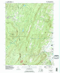
1990 Map of Iron Springs
USGS Topo · Published 1995About this map
Michaux State Forest dominates the high ground of the Adams and Franklin County border, where the Appalachian Trail weaves through a network of rocky summits like Buzzard Peak and Chimney Rocks. This terrain is defined by the heavy infrastructure of water management and healthcare, most notably the South Mountain Restoration Center and multiple reservoirs including the Carbaugh Reservoir. To the east, the landscape softens into the agricultural and residential valleys of Fairfield and Carroll Valley, where small settlements like Virginia Mills and Iron Springs cluster near the banks of Toms Creek and Middle Creek. The map documents a transition from the preserved wilderness and the Ranger Station of the forest to the established educational and civic life centered at Fairfield High Sch and several country cemeteries like St Marys Cem.
Find a feature on this map
70 named features on this map. Tap any name to fly to it.
Don’t see what you’re looking for? This feature index may not catch every label — zoom into the map to look around manually.
Map Details
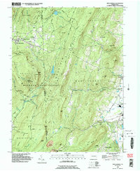
Editions of this 1990 Iron Springs Map
2 editions found
Other maps of this area

1902 · Chambersburg
USGS Topo · 1:62,500

1909 · Fairfield
USGS Topo · 1:62,500

1909 · Hagerstown
USGS Topo · 1:48,000

1911 · Emmitsburg
USGS Topo · 1:62,500

1912 · Hagerstown
USGS Topo · 1:62,500

1942 · Hagerstown
USGS Topo · 1:125,000

1942 · Gettysburg
USGS Topo · 1:125,000

1943 · Emmitsburg
USGS Topo · 1:62,500

1943 · Hagerstown
USGS Topo · 1:125,000

1943 · Chambersburg
USGS Topo · 1:62,500
Featured Places
- Quincy Township, PA
- Guilford Township, PA
- Franklin Township, PA
- Hamiltonban Township, PA
- Maria Furnace, Hamiltonban Township