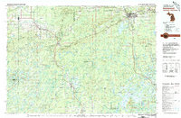
1980 Map of Ironwood
USGS Topo · Published 1980About this map
The Gogebic Range dominates this 1980 survey, illustrating the industrial and natural landscape of the Michigan-Wisconsin borderlands. Centered on the sister cities of Ironwood and Hurley, the map documents the region's mining legacy through features like the Peterson Mine and infrastructure including the Grandview Hospital and Municipal Airport. The transition from mining hubs to protected lands is evident in the inclusion of Copper Falls State Park and the expansive Chequamegon National Forest.
Find a feature on this map
224 named features on this map. Tap any name to fly to it.
Don’t see what you’re looking for? This feature index may not catch every label — zoom into the map to look around manually.
Map Details
Editions of this 1980 Ironwood Map
This is the sole edition of this map. No revisions or reprints were ever made.
Other maps of this area

1938 · Lac Du Flambeau
USGS Topo · 1:48,000

1939 · Lac Du Flambeau
USGS Topo · 1:48,000

1939 · Winchester
USGS Topo · 1:48,000

1940 · Mercer
USGS Topo · 1:48,000

1940 · Butternut
USGS Topo · 1:48,000

1940 · Upson
USGS Topo · 1:48,000

1941 · Park Falls
USGS Topo · 1:48,000

1941 · Pike Lake
USGS Topo · 1:48,000

1941 · Kennedy
USGS Topo · 1:48,000

1942 · Pike Lake
USGS Topo · 1:48,000