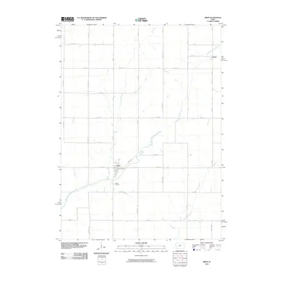
2010 Map of Irwin
USGS Topo · Published 2010About this map
Irwin sits at the heart of this agricultural landscape, where the local economy and social life center around the Irwin Post Office and the surrounding township roads. The town's layout follows a classic Midwestern grid, settled near the confluence of local drainages that feed into the West Nishnabotna River. To the south, Oak Hill Cemetery provides a primary point of interest for genealogists tracing family roots in this corner of Shelby County.
Find a feature on this map
33 named features on this map. Tap any name to fly to it.
Don’t see what you’re looking for? This feature index may not catch every label — zoom into the map to look around manually.
Map Details
Editions of this 2010 Irwin Map
This is the sole edition of this map. No revisions or reprints were ever made.
Other maps of this area

1954 · Omaha
USGS Topo · 1:250,000

1957 · Omaha
USGS Topo · 1:250,000

1958 · Omaha
USGS Topo · 1:250,000

1971 · Earling NE
USGS Topo · 1:24,000

1971 · Defiance
USGS Topo · 1:24,000

1978 · Manilla
USGS Topo · 1:24,000

1978 · Irwin
USGS Topo · 1:24,000

1978 · Kimballton
USGS Topo · 1:24,000

1978 · Manning
USGS Topo · 1:24,000
1978 · Harlan
USGS Topo · 1:24,000