
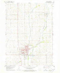
1978 Map of Irwin
USGS Topo · Published 1978About this map
Irwin sits at the heart of this Shelby County landscape, where the Chicago and North Western railroad parallels the course of the West Nishnabotna River. The settlement pattern reflects the mid-century agricultural organization of western Iowa, with the map recording the precise locations of a municipal Water Tank and a Well crucial to local infrastructure. Outside of the town center, the terrain is defined by the branching waters of Elk Creek and Long Branch, which carve through the townships of Greeley and Jefferson. Genealogists will find the Oak Hill Cem south of the main settlement, while the smaller community of Botna appears near the northern boundary, highlighting the historical corridor of rail-to-river transport that shaped this part of the state.
Find a feature on this map
18 named features on this map. Tap any name to fly to it.
Don’t see what you’re looking for? This feature index may not catch every label — zoom into the map to look around manually.
Map Details
Editions of this 1978 Irwin Map
This is the sole edition of this map. No revisions or reprints were ever made.
Other maps of this area

1954 · Omaha
USGS Topo · 1:250,000

1957 · Omaha
USGS Topo · 1:250,000

1958 · Omaha
USGS Topo · 1:250,000

1971 · Earling NE
USGS Topo · 1:24,000

1971 · Defiance
USGS Topo · 1:24,000

1978 · Manilla
USGS Topo · 1:24,000

1978 · Kimballton
USGS Topo · 1:24,000

1978 · Manning
USGS Topo · 1:24,000
1978 · Harlan
USGS Topo · 1:24,000
1978 · Manning SE
USGS Topo · 1:24,000