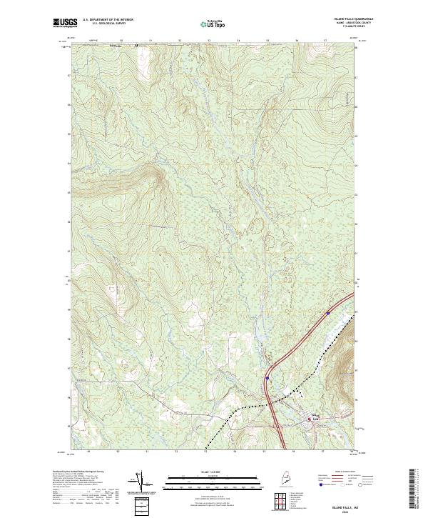
2024 Map of Island Falls
USGS Topo · Published 2024About this map
The village of Island Falls anchors the southeastern corner of this Aroostook County landscape, situated where Fish Stream meets the West Branch Mattawamkeag River. This modern survey reveals a region deeply shaped by the timber industry and historical land management, evidenced by the extensive network of forest roads such as Champion Paper Rd and St Regis Paper Rd that penetrate the dense northern woods. The terrain rises toward Robinson Mtn in the east and the long spine of Delette Ridge, while the river system remains the central geographic feature, punctuated by Stair Falls. In the northern reaches, the small settlement of Batesville and the nearby Bates Cem offer specific points of interest for genealogists tracking early families along the Moro Townline Rd and Town Line RD.
Find a feature on this map
37 named features on this map. Tap any name to fly to it.
Don’t see what you’re looking for? This feature index may not catch every label — zoom into the map to look around manually.
Map Details
Editions of this 2024 Island Falls Map
This is the sole edition of this map. No revisions or reprints were ever made.
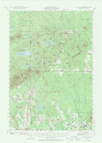
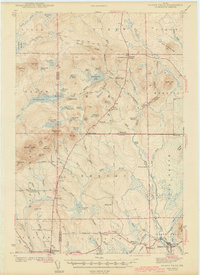
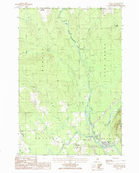
Historical Maps of Island Falls Through Time
4 maps found