Loading...
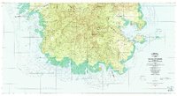
Loading map...1983 Map of Island Of Ponape (South Half)
USGS Topo · Published 1983About this map
Dense mangrove forests and interior mountainous terrain define this 1980s landscape of the southern Federated States of Micronesia. Several municipalities, including Kiti Municipality and Madolenihmw Municipality, meet along the interior ridges of the island. Coastal settlements such as Pahn Kiper and Tomwara dot the western shores, while the eastern side is marked by the large island of Temwen and the intricate bay of Nanmwohnwei.
Find a feature on this map
119 named features on this map. Tap any name to fly to it.
Don’t see what you’re looking for? This feature index may not catch every label — zoom into the map to look around manually.
Map Details
Date Portrayed1983
Date Published1983
PublisherU.S. Geological Survey
Map TypeTopographic
Scale1:25,000
Physical Dimensions53.7 x 29.3 inches
Editions of this 1983 Island Of Ponape (South Half) Map
This is the sole edition of this map. No revisions or reprints were ever made.
Other maps of this area
Featured Places
Source Details
SourceU.S. Geological Survey
CopyrightPublic Domain