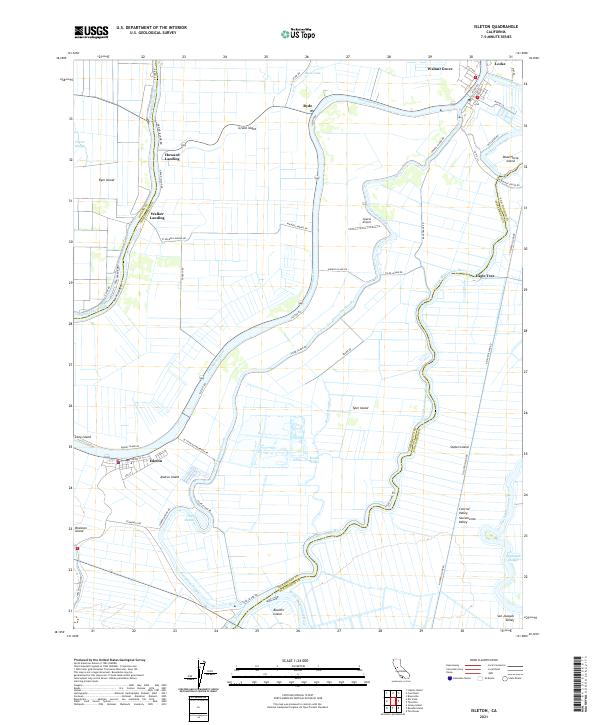
2021 Map of Isleton
USGS Topo · Published 2021About this map
Sacramento River and the complex waterways of the California Delta define this region, where the Sacramento, Solano, and San Joaquin county lines converge. The landscape is a network of large reclaimed tracts, including Grand Island, Tyler Island, and Staten Island, protected by a series of levees and sloughs. The river towns of Isleton and Walnut Grove serve as historic hubs for the agricultural commerce of the Central Valley, while the unique community of Locke stands as a distinct cultural landmark along the Delta-Cross Channel.
Find a feature on this map
60 named features on this map. Tap any name to fly to it.
Don’t see what you’re looking for? This feature index may not catch every label — zoom into the map to look around manually.
Map Details
Editions of this 2021 Isleton Map
This is the sole edition of this map. No revisions or reprints were ever made.
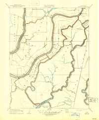
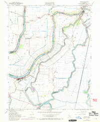
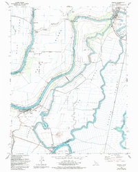
Historical Maps of Walker Landing Through Time
4 maps found