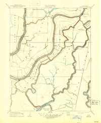
1910 Map of Isleton
USGS Topo · Published 1947About this map
Sacramento River waters define this agricultural landscape in the California Delta, where islands are separated by an intricate network of sloughs and river forks. In the early twentieth century, these waterways were the primary arteries for commerce and travel, connecting riverfront settlements like Walnut Grove and Isleton. The presence of the Golden State Cannery on the edge of Bouldin Island highlights the region's historical reliance on river-based industry and fruit packing.
Find a feature on this map
28 named features on this map. Tap any name to fly to it.
Don’t see what you’re looking for? This feature index may not catch every label — zoom into the map to look around manually.
Map Details
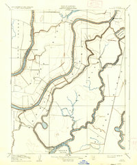
Editions of this 1910 Isleton Map
3 editions found
Other maps of this area

1894 · Lodi
USGS Topo · 1:125,000

1908 · Courtland
USGS Topo · 1:62,500

1910 · New Hope
USGS Topo · 1:31,680

1910 · Rio Vista
USGS Topo · 1:31,680

1910 · Bouldin
USGS Topo · 1:31,680

1910 · Jersey
USGS Topo · 1:31,680

1910 · Bruceville
USGS Topo · 1:31,680

1910 · Headreach
USGS Topo · 1:31,680

1910 · Isleton
USGS Topo · 1:31,680

1916 · Cache Slough
USGS Topo · 1:31,680