
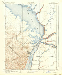
1910 Map of Rio Vista
USGS Topo · Published 1910About this map
The Sacramento River carves a deep channel through this 1910 delta landscape, separating the intricate island system of the east from the rising Montezuma Hills to the west. Around the town of Rio Vista, the map details a world of sloughs and reclaimed marshland, where the Yolo Basin meets the agricultural potential of Ryer Island and Grand Island. The layout of the period reveals a river-dependent economy, evidenced by the Pumping Plant on the northern end of Ryer Island and the specific placement of a Blacksmith Shop near the hills.
Find a feature on this map
23 named features on this map. Tap any name to fly to it.
Don’t see what you’re looking for? This feature index may not catch every label — zoom into the map to look around manually.
Map Details
Editions of this 1910 Rio Vista Map
2 editions found
Other maps of this area

1907 · Antioch
USGS Topo · 1:62,500

1908 · Vacaville
USGS Topo · 1:62,500

1908 · Courtland
USGS Topo · 1:62,500

1908 · Antioch
USGS Topo · 1:62,500

1910 · Bouldin
USGS Topo · 1:31,680

1910 · Jersey
USGS Topo · 1:31,680

1910 · Isleton
USGS Topo · 1:31,680

1916 · Cache Slough
USGS Topo · 1:31,680

1916 · Vorden
USGS Topo · 1:31,680

1916 · Maine Prairie
USGS Topo · 1:31,680