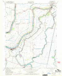
1952 Map of Isleton
USGS Topo · Published 1969About this map
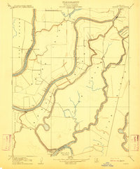
The Sacramento River Delta is defined here by a intricate network of levees, islands, and sloughs as they appeared during the mid-century. The settlement of Isleton anchors the south, served by the Southern Pacific railroad and surrounded by a landscape increasingly dominated by energy extraction, evidenced by numerous Gas Wells scattered across the low-lying tracts. To the north, the historic community of Locke and the river town of Walnut Grove sit along the primary bend of the Sacramento River, while the Delta Cross Channel signifies significant hydraulic engineering of the era. This 1952 survey, with later 1968 purple-ink revisions, captures the vital transit points of the delta, including riverfront landings like Walker Landing and Howard Landing. Rural education centers such as Ryer Island Sch and Beaver Union Sch reflect the community structure of the reclaimed islands before modern consolidation.
Find a feature on this map
37 named features on this map. Tap any name to fly to it.
Don’t see what you’re looking for? This feature index may not catch every label — zoom into the map to look around manually.
Map Details
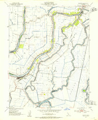
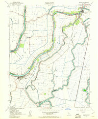
Editions of this 1952 Isleton Map
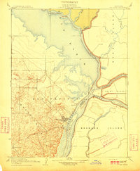
Other maps of this area

1894 · Lodi
USGS Topo · 1:125,000

1908 · Courtland
USGS Topo · 1:62,500

1910 · New Hope
USGS Topo · 1:31,680
1910 · Rio Vista
USGS Topo · 1:31,680

1910 · Bouldin
USGS Topo · 1:31,680

1910 · Jersey
USGS Topo · 1:31,680

1910 · Bruceville
USGS Topo · 1:31,680

1910 · Headreach
USGS Topo · 1:31,680
1910 · Isleton
USGS Topo · 1:31,680

1916 · Cache Slough
USGS Topo · 1:31,680