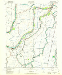
1952 Map of Isleton
USGS Topo · Published 1961About this map
Ryer Island, Grand Island, and Staten Island dominate this 1952 topographic study of the Sacramento-San Joaquin River Delta. This era captures the intricate relationship between agricultural reclamation and the massive water engineering projects of the mid-20th century. The Delta Cross Channel is shown north of Walnut Grove, a critical component for diverting water from the Sacramento River toward the pumps of the south. Settlements such as Locke and Ryde line the levees, reflecting the river-oriented development of the region.
Find a feature on this map
41 named features on this map. Tap any name to fly to it.
Don’t see what you’re looking for? This feature index may not catch every label — zoom into the map to look around manually.
Map Details
Editions of this 1952 Isleton Map
Other maps of this area

1894 · Lodi
USGS Topo · 1:125,000

1908 · Courtland
USGS Topo · 1:62,500

1910 · New Hope
USGS Topo · 1:31,680

1910 · Rio Vista
USGS Topo · 1:31,680

1910 · Bouldin
USGS Topo · 1:31,680

1910 · Jersey
USGS Topo · 1:31,680

1910 · Bruceville
USGS Topo · 1:31,680

1910 · Headreach
USGS Topo · 1:31,680

1910 · Isleton
USGS Topo · 1:31,680

1916 · Cache Slough
USGS Topo · 1:31,680