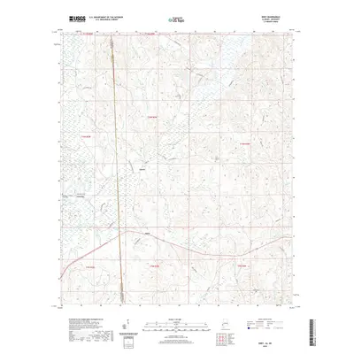
2020 Map of Isney
USGS Topo · Published 2020About this map
The borderlands of Alabama and Mississippi near Isney are defined by a complex drainage system feeding the Buckatunna Creek watershed. This 2020 topographic record highlights a region characterized by small rural settlements like Emory and a network of cemeteries including Old Bethel Cem, Pine Grove Cem, and Loften Cem, which provide essential points of reference for genealogical research in Choctaw County.
Find a feature on this map
54 named features on this map. Tap any name to fly to it.
Don’t see what you’re looking for? This feature index may not catch every label — zoom into the map to look around manually.
Map Details
Editions of this 2020 Isney Map
This is the sole edition of this map. No revisions or reprints were ever made.
Other maps of this area

1953 · Hattiesburg
USGS Topo · 1:250,000

1958 · Hattiesburg
USGS Topo · 1:250,000

1964 · Carmichael
USGS Topo · 1:24,000

1964 · Denham
USGS Topo · 1:24,000

1964 · Matherville
USGS Topo · 1:24,000

1974 · Melvin
USGS Topo · 1:24,000

1974 · Millry North
USGS Topo · 1:24,000

1974 · Silas
USGS Topo · 1:24,000

1974 · Isney
USGS Topo · 1:24,000
1974 · Aquilla
USGS Topo · 1:24,000