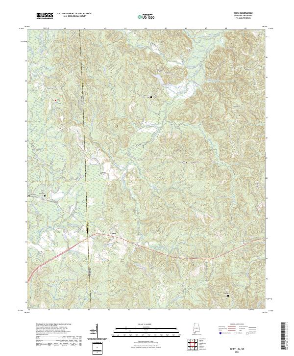
2024 Map of Isney
USGS Topo · Published 2024About this map
The borderlands of Choctaw County, Alabama, and Wayne County, Mississippi, are defined by a complex network of waterways that shaped the development of early settlements like Isney and Emory. The terrain is deeply carved by drainage systems including Puss Cuss Creek, Buckatunna Creek, and Souwilpa Creek, which likely dictated the placement of pioneer-era roads such as Matherville Frost Bridge Rd and Isney Cedar Hammock Rd. This 2024 landscape retains much of its rural character, anchored by historic community focal points such as Old Bethel Cem, Pine Grove Cem, and Salem Cem. The presence of features like Lamar Mill Creek points toward the early water-powered industry that once supported these remote woodland communities, while contemporary routes like The Zion Rd and Wildflower Rd now connect these long-standing family and cultural landmarks.
Find a feature on this map
51 named features on this map. Tap any name to fly to it.
Don’t see what you’re looking for? This feature index may not catch every label — zoom into the map to look around manually.
Map Details
Editions of this 2024 Isney Map
This is the sole edition of this map. No revisions or reprints were ever made.
Other maps of this area

1953 · Hattiesburg
USGS Topo · 1:250,000

1958 · Hattiesburg
USGS Topo · 1:250,000

1964 · Carmichael
USGS Topo · 1:24,000

1964 · Denham
USGS Topo · 1:24,000

1964 · Matherville
USGS Topo · 1:24,000

1974 · Melvin
USGS Topo · 1:24,000

1974 · Millry North
USGS Topo · 1:24,000

1974 · Silas
USGS Topo · 1:24,000

1974 · Isney
USGS Topo · 1:24,000
1974 · Aquilla
USGS Topo · 1:24,000