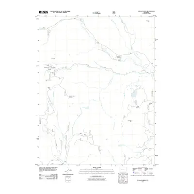
2011 Map of Italian Creek
USGS Topo · Published 2011About this map
American Flag Mountain and the surrounding high-altitude terrain of Gunnison County define this map of a legacy mining district. The landscape is densely marked with early extraction sites, concentrated heavily around the headwaters of Italian Creek. This concentration of claims, including the Colorado Mine, Independent Shaft Mine, and Bull Domingo Shaft Mine, reflects the intensity of late 19th and early 20th-century prospecting in the Colorado Rockies. The remote nature of these operations is underscored by their proximity to prominent peaks like Forest Hill and the winding course of the Taylor River.
Find a feature on this map
34 named features on this map. Tap any name to fly to it.
Don’t see what you’re looking for? This feature index may not catch every label — zoom into the map to look around manually.
Map Details
Editions of this 2011 Italian Creek Map
This is the sole edition of this map. No revisions or reprints were ever made.
Other maps of this area

1888 · Crested Butte
USGS Topo · 1:62,500

1889 · Crested Butte
USGS Topo · 1:62,500

1893 · Crested Butte
USGS Topo · 1:62,500

1893 · Aspen
USGS Topo · 1:62,500

1895 · Aspen
USGS Topo · 1:62,500

1909 · Mount Jackson
USGS Topo · 1:125,000

1911 · Mount Jackson
USGS Topo · 1:125,000

1934 · Taylor Park
USGS Topo · 1:62,500

1937 · Taylor Park
USGS Topo · 1:62,500

1956 · Montrose
USGS Topo · 1:250,000