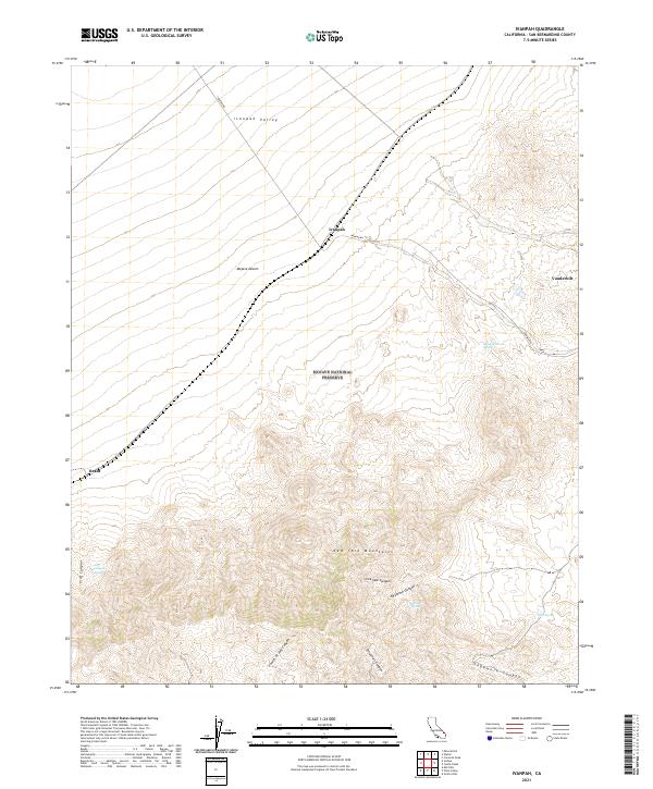
2021 Map of Ivanpah
USGS Topo · Published 2021About this map
The Mojave National Preserve encompasses most of this landscape, where the sharp rise of the New York Mountains breaks the broad expanse of the Ivanpah Valley. This modern topographic study shows the enduring footprints of small desert outposts like Ivanpah, Vanderbilt, and Brant, locations that served as vital hubs during the region's mining and ranching eras. The terrain is deeply incised by numerous drainages, including Caruthers Canyon, Sagamore Canyon, and Live Oak Canyon, which funnel seasonal runoff toward the desert floor.
Find a feature on this map
22 named features on this map. Tap any name to fly to it.
Don’t see what you’re looking for? This feature index may not catch every label — zoom into the map to look around manually.
Map Details
Editions of this 2021 Ivanpah Map
This is the sole edition of this map. No revisions or reprints were ever made.
Other maps of this area

1910 · Ivanpah
USGS Topo · 1:250,000

1912 · Ivanpah
USGS Topo · 1:250,000

1942 · Ivanpah
USGS Topo · 1:250,000

1947 · Kingman
USGS Topo · 1:250,000

1948 · Kingman
USGS Topo · 1:250,000

1954 · Kingman
USGS Topo · 1:250,000

1955 · Kingman
USGS Topo · 1:250,000

1955 · Mid Hills
USGS Topo · 1:62,500
1956 · Lanfair Valley
USGS Topo · 1:62,500

1956 · Ivanpah
USGS Topo · 1:62,500