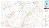
1985 Map of Ivanpah
USGS Topo · Published 1985About this map
The East Mojave National Scenic Area dominates this high-desert landscape in the mid-1980s, revealing a complex network of mining operations and isolated desert settlements. The Union Pacific railroad serves as a primary transit corridor, connecting hubs like Kelso, Cima, and Ivanpah. The map illustrates a region defined by its industrial history, with numerous extraction sites such as the Morning Star Mine, Death Valley Mine, and Mohawk Mine dotting the mountain ranges. Significant topographic features like Cima Dome and the New York Mountains rise above the alluvial plains and dry lake beds. The historic Mojave Road traverses the terrain, following a path through Lanfair Valley and past vital water sources like Halloran Spring and Rainbow Wells, which were essential for desert passage before modern infrastructure.
Find a feature on this map
130 named features on this map. Tap any name to fly to it.
Don’t see what you’re looking for? This feature index may not catch every label — zoom into the map to look around manually.
Map Details
Editions of this 1985 Ivanpah Map
2 editions found
Other maps of this area

1886 · Camp Mohave
USGS Topo · 1:250,000

1892 · Camp Mohave
USGS Topo · 1:250,000

1910 · Ivanpah
USGS Topo · 1:250,000

1912 · Ivanpah
USGS Topo · 1:250,000

1926 · Nelson
USGS Topo · 1:96,000

1926 · Mohave City
USGS Topo · 1:96,000

1933 · Avawatz Mountains
USGS Topo · 1:250,000

1942 · Camp Mohave
USGS Topo · 1:250,000

1942 · Ivanpah
USGS Topo · 1:250,000

1942 · Amboy
USGS Topo · 1:250,000