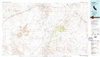
1985 Map of Ivanpah
USGS Topo · Published 1985About this map
The East Mojave National Scenic Area dominates this mid-1980s landscape, illustrating a vast region of the high desert before its transition into a formal national preserve. The map highlights the rugged geology of the Cinder Cone Lava Beds and the symmetrical Cima Dome, surrounded by the wide expanses of Ivanpah Valley and Lanfair Valley. Human activity is concentrated along the Union Pacific railroad corridor, which connects small settlements like Cima and Nipton to the broader regional economy.
Find a feature on this map
39 named features on this map. Tap any name to fly to it.
Don’t see what you’re looking for? This feature index may not catch every label — zoom into the map to look around manually.
Map Details
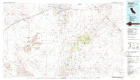
Editions of this 1985 Ivanpah Map
2 editions found
Other maps of this area

1886 · Camp Mohave
USGS Topo · 1:250,000

1892 · Camp Mohave
USGS Topo · 1:250,000

1910 · Ivanpah
USGS Topo · 1:250,000

1912 · Ivanpah
USGS Topo · 1:250,000

1926 · Nelson
USGS Topo · 1:96,000

1926 · Mohave City
USGS Topo · 1:96,000

1933 · Avawatz Mountains
USGS Topo · 1:250,000

1942 · Camp Mohave
USGS Topo · 1:250,000

1942 · Ivanpah
USGS Topo · 1:250,000

1942 · Amboy
USGS Topo · 1:250,000