Loading...
Loading map...2022 Map of Ivester
USGS Topo · Published 2022About this map
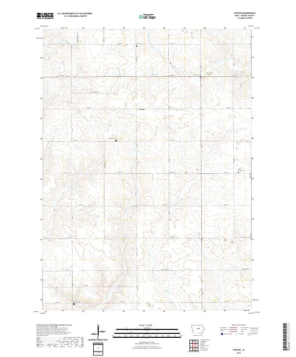
Ivester serves as a central landmark in this portion of Grundy County, where a grid of section-line roads like 240th St and G Ave organize the Iowa prairie. The landscape is defined by the headwaters and branches of numerous waterways, including the winding paths of Wolf Creek, Black Hawk Creek, and Doud Creek. To the southwest, the settlement of Whitten sits near the border of the survey, reflecting the agricultural and residential patterns of the early 21st century.
Find a feature on this map
36 named features on this map. Tap any name to fly to it.
Don’t see what you’re looking for? This feature index may not catch every label — zoom into the map to look around manually.
Map Details
Date Portrayed2022
Date Published2022
PublisherU.S. Geological Survey
Map TypeTopographic
Scale1:24000
Physical Dimensions24 x 29 inches
Editions of this 2022 Ivester Map
This is the sole edition of this map. No revisions or reprints were ever made.
Historical Maps of Ivester Through Time
4 maps found
Featured Locations
Source Details
SourceU.S. Geological Survey
CopyrightPublic Domain