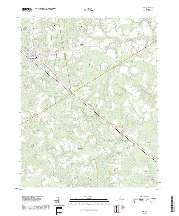
2022 Map of Ivor
USGS Topo · Published 2022About this map
Wakefield and Ivor anchor the northwestern and southeastern corners of this Tidewater Virginia landscape, where the agricultural plains of Sussex and Southampton counties meet. The region is defined by a dense network of watercourses, including the expansive Seacock Swamp and Terrapin Swamp, which weave between small settlements like Saddlers Crossroads and Booth Fork. Transportation history is legible through the alignment of Railroad Ave and the modern Wakefield Municipal Airport. Local heritage is preserved in sites such as Booker T Memorial Park and several family or community burial grounds, including Spratley Cem and the Stephenson Cem. The map illustrates a rural landscape where timber and farming remain central, evidenced by the numerous ponds like Drumwright Pond and Parker Number One Pond that dot the drainage basins between the Blackwater and Nottoway river systems.
Find a feature on this map
75 named features on this map. Tap any name to fly to it.
Don’t see what you’re looking for? This feature index may not catch every label — zoom into the map to look around manually.
Map Details
Editions of this 2022 Ivor Map
This is the sole edition of this map. No revisions or reprints were ever made.
Other maps of this area

1919 · Surry
USGS Topo · 1:62,500

1919 · Disputanta
USGS Topo · 1:62,500

1919 · Homeville
USGS Topo · 1:48,000

1920 · Ivor
USGS Topo · 1:62,500

1920 · Homeville
USGS Topo · 1:62,500

1943 · Manry
USGS Topo · 1:31,680

1943 · Vicksville
USGS Topo · 1:31,680

1943 · Richmond
USGS Topo · 1:250,000

1944 · Waverly
USGS Topo · 1:31,680

1944 · Ivor
USGS Topo · 1:24,000