Old Maps of Surry County, Virginia
Explore 111 old maps of Surry County, spanning from 1907 to today. These high-resolution historic maps reveal how streets, neighborhoods, landmarks, and natural features evolved over time — perfect for genealogy, metal detecting, research, and local history exploration.
What you can do with these maps:
- See how Surry County changed over time: Compare historical maps to modern-day views to trace roads, homesites, rail lines & more.
- View detailed metadata: Each map includes creators, publishers, year, scale, and archive source.
- Overlay maps with satellite & LiDAR: Visualize the past alongside modern tools to explore terrain & human change.
- Trusted historical sources: Maps sourced from the USGS, Library of Congress, and other archives.
- Access maps your way: View online, download high-res files, or order prints for personal or research use.
Start exploring old maps of Surry County to uncover forgotten places, hidden landmarks, and the deep history beneath your feet.
Surry County, VA maps
(111)- 1907 Map of Yorktown
 1907 Yorktown1907 Print · USGSThe Virginia Peninsula and the banks of the James River are shown here at the turn of the century, revealing a landscape defined by colonial roots and Civil War defenses. Genealogists can trace early twentieth-century life at Denbigh P O, Bacons Castle, and the National Cem.6 unique versions available
 - 1919 Map of Surry
 1919 Surry1919 Print · USGSSurry County and the James River tidewater are captured in the late teens, when timber and steamboats still drove the local economy. Researchers can locate vanished landmarks like Spratleys Mill, the Old Courthouse, and numerous schoolhouses including Rough School and Cypress School.3 unique versions available
 - 1919 Map of Disputanta
 1919 Disputanta1919 Print · USGSCoastal Virginia during the late teens is characterized by a landscape of tidal creeks and rail-connected agricultural towns. Genealogists can locate family landmarks like Sycamore Church, Star Hill School, and the scattered hamlets of Newville and Garysville.3 unique versions available
 - 1920 Map of Ivor
 1920 Ivor1920 Print · USGSCoastal plain life in Southampton and Isle of Wight counties is captured here just after the Great War, when rail and river travel still shaped the landscape. Genealogists can locate family landmarks like Tucker Swamp Church, Crumplers School, and Millfield Millpond.2 unique versions available
 - 1943 Map of Yorktown
 1943 Yorktown1943 Print · USGSThe Virginia Tidewater is captured here during the Second World War, showing the strategic riverfronts of the James and Warwick rivers. Researchers can locate colonial landmarks and defensive ruins like Old Fort Yorktown, Bacons Castle, and Warwick Courthouse.
 - 1943 Map of Savedge
 1943 Savedge1943 Print · USGSSurry and Prince George Counties appear here during the Second World War as a landscape of timber mills and tidal creeks. Genealogists can locate family landmarks like the Lone Oak Grist Mill, Burrowsville, and Gravel Hill Church.
 - 1943 Map of Disputanta
 1943 Disputanta1943 Print · USGSPrince George County is shown in the early 1940s as a landscape of timber-rich swamps and rural crossroads. Local historians can trace family locations near Seldons Store, Old Academy School, and the National Moorish Home.
 - 1943 Map of Richmond, 1972 Print
 1943 Richmond1972 Print · USGSCoastal Virginia and the state capital are shown in detail during the mid-century era of infrastructure expansion. Genealogists and historians can trace the grounds of Richmond Nat Battlefield Park, locate the Yorktown Nat Cem, or follow the many rural routes through Amelia Court House and Tappahannock.
 - 1944 Map of Waverly
 1944 Waverly1944 Print · USGSSurry and Sussex Counties during the mid-forties reveal a landscape of timber industry and swampy lowlands centered on the rail-connected town of Waverly. Genealogists and local historians can locate rural landmarks like Zion Hill Church, Gwaltney Corner, and several distinct Sawmill sites.
 - 1944 Map of Nebletts Mill
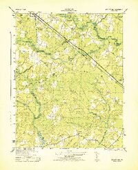 1944 Nebletts Mill1944 Print · USGSCoastal plain wetlands and small rail-side settlements define this part of Sussex County during the mid-forties. Genealogists and local historians can trace the rural landscape surrounding Disputanta, the grounds of Newville Church, and the waters of Nebletts Mill Pond.
 - 1944 Map of Ivor, 1961 Print
 1944 Ivor1961 Print · USGSCoastal Virginia during the mid-forties reveals a landscape of dense swamps and railroad-oriented towns. Genealogists and local historians can trace family roots through landmarks like Stephenson Cem, Mars Hill Ch, and the schools at Ivor.
 - 1944 Map of Raynor, 1961 Print
 1944 Raynor1961 Print · USGSCoastal Virginia during the mid-1940s reveals a landscape defined by the winding Blackwater River and its vast marshlands. Genealogists and historians can locate rural crossroads like McClelland and study the sites of Godwin Sch or Mill Swamp Ch.
 - 1945 Map of Ivor
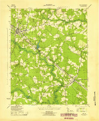 1945 Ivor1945 Print · USGSCoastal Virginia's Tidewater region comes to life in the years following the war, centered on the railroad towns of Wakefield and Ivor. Genealogists and local historians can trace rural family life through meticulously marked sites like Stephenson Cem, Keitos Mill, and the Oak Grove School.
 - 1945 Map of Raynor
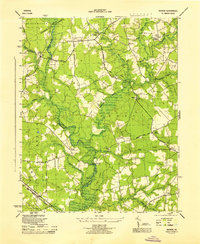 1945 Raynor1945 Print · USGSIsle of Wight County remains a landscape of deep timber and blackwater swamps at the close of World War II. Researchers can locate family landmarks like Mill Swamp Ch and Cem, McClelland Sch, and crossroads at Gwaltney Crossroads.
 - 1947 Map of Nebletts Mills
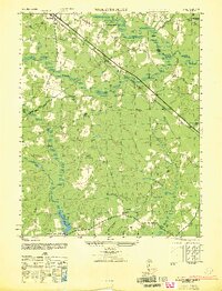 1947 Nebletts Mills1947 Print · USGSCoastal Virginia during the late 1940s reveals a landscape of dense swamps and vital rail corridors connecting rural communities. Genealogists and local historians can trace the foundations of Disputanta and Newville, or locate landmarks like Cinema Church and Nebletts Millpond.
 - 1948 Map of Bacons Castle, 1953 Print
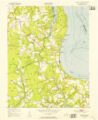 1948 Bacons Castle1953 Print · USGSCoastal Surry and Isle of Wight counties are captured in the late 1940s, showing a landscape of historic landings and rural parish life. Genealogists can locate family names at Lower Surry Cemetery or trace landmarks like Bacons Castle and the Lower Surry Ruins.
 - 1949 Map of Richmond, 1951 Print
 1949 Richmond1951 Print · USGSCoastal Virginia in the years following World War II remained a landscape of historic river towns and expanding military bases. Genealogists and historians can trace the rail lines of the Southern Ry and locate established landmarks from Camp Lee to the remote reaches of Dragon Swamp.
 - 1950 Map of Cobham Bay, 1953 Print
 1950 Cobham Bay1953 Print · USGSThe James River waterfront is frozen in time at mid-century, showing the early boundaries of the Colonial National Historical Monument. Researchers can trace the rural landscape from Jamestown Island to the remote lighthouses at Homewood and Deepwater Shoals.
 - 1953 Map of Norfolk, 1954 Print
 1953 Norfolk1954 Print · USGSCoastal Virginia and northeastern North Carolina appear here during the post-war industrial boom, showing the critical rail-and-sea connections of Hampton Roads. Genealogists can trace family roots through rural landmarks like Gethsemane Ch, the Caledonia State Prison Farm, and the vast interior of the Dismal Swamp.4 unique versions available
 - 1953 Map of Surry, 1957 Print
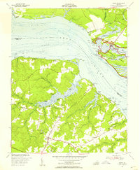 1953 Surry1957 Print · USGSThe James River shoreline and the historic grounds of Jamestown appear here during the early 1950s. Genealogists and historians can trace old property lines and community centers from Four Mile Tree Plantation and Smith Fort Plantation to the Lehmen Schools.
 - 1954 Map of Claremont, 1957 Print
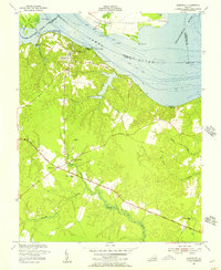 1954 Claremont1957 Print · USGSSurry County river life and crossroads farming define this mid-fifties landscape along the James River. Genealogists and local historians can trace the foundations of Claremont, locate the Spring Grove Sch, and find family sites like Debricks Cem.
 - 1954 Map of Dendron, 1957 Print
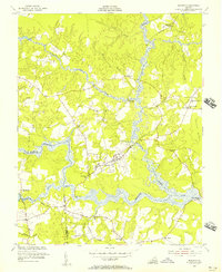 1954 Dendron1957 Print · USGSDendron and the surrounding Surry County wetlands are captured here in the mid-1950s as a landscape of rural churches and winding swamp crossings. Genealogists can locate family landmarks such as Spratleys Mill, Union Ch, and the settlement at Elberon.
 - 1954 Map of Runnymede, 1957 Print
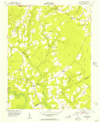 1954 Runnymede1957 Print · USGSSurry and Isle of Wight counties appear here in the mid-fifties, characterized by a complex network of pocosin wetlands and small farming settlements. Researchers can trace the layout of community landmarks like Derrings Mill, Cypress Sch, and Berrymans Corner.
 - 1956 Map of Disputanta North, 1958 Print
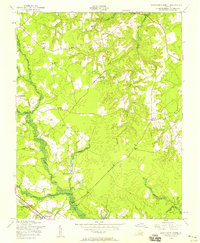 1956 Disputanta North1958 Print · USGSPrince George County is seen here in the mid-1950s, a landscape of intricate swamplands and rural crossroads. Researchers can trace the Norfolk and Western rail line through Disputanta or locate sites like the National Moorish Home and Old Academy Sch.
 - 1956 Map of Savedge, 1958 Print
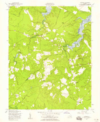 1956 Savedge1958 Print · USGSSurry and Prince George Counties appear here in the mid-fifties, still defined by a network of rural churches and tidal waterways. Researchers can trace the locations of the Lone Oak Grist Mill and settlements like Burrowsville and Barham.
Showing maps 1-25 of 111
Top cities of Surry County
Frequently asked questions
- What are the different types of historical maps available for Surry County?
- What is the oldest map of Surry County?
- Where can I purchase historical maps of Surry County for my home or office?
- Where can I download high-res historical maps of Surry County?
- Are there historical topographic maps available for Surry County?
- Is there historical aerial imagery available for Surry County?
- Where are historical maps of Surry County sourced from?