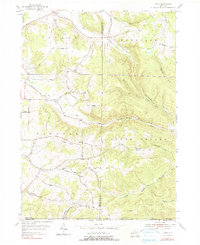
1954 Map of Ivory
USGS Topo · Published 1991About this map
Ivory and Clark anchor this mid-century look at the southeastern corner of Chautauqua County, where the hills of Poland and Carroll meet the Cattaraugus County line. The landscape is defined by a dense network of upland drainage including Little Bone Run and Sawmill Run, which carve through the high ground of Oak Hill and Emory Hill. Local social centers are clearly marked at the Oak Hill Ch and Wheeler Hill Ch, while the Oak Hill Cem provides a specific point of interest for genealogical research. The presence of the Radio Tower (WFTM) near the Carroll township line indicates the mid-century communications infrastructure. The winding paths of Harrington Road and Scott Road reflect a settlement pattern dictated by the steep drainages of Conewango Creek and its various tributaries.
Find a feature on this map
47 named features on this map. Tap any name to fly to it.
Don’t see what you’re looking for? This feature index may not catch every label — zoom into the map to look around manually.
Map Details
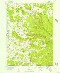
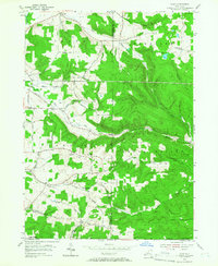
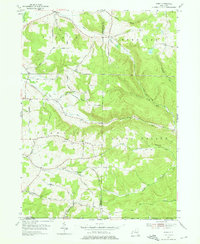
Editions of this 1954 Ivory Map
4 editions found
Other maps of this area

1905 · Jamestown
USGS Topo · 1:62,500

1906 · Warren
USGS Topo · 1:62,500

1907 · Warren
USGS Topo · 1:62,500

1908 · Warren
USGS Topo · 1:62,500

1922 · Randolph
USGS Topo · 1:62,500

1923 · Randolph
USGS Topo · 1:62,500

1936 · Kinzua
USGS Topo · 1:48,000

1941 · Kinzua
USGS Topo · 1:62,500

1942 · Jamestown
USGS Topo · 1:62,500

1943 · Randolph
USGS Topo · 1:62,500