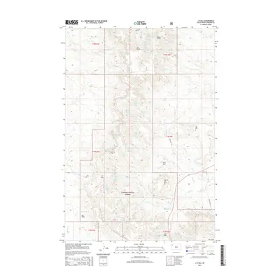
2015 Map of J B Hill
USGS Topo · Published 2015About this map
Slim Buttes rises as the primary topographical feature in this corner of the Custer National Forest, where a complex system of drainage and natural springs defines the High Plains landscape. The map centers on the high ground of JB Hill and the essential transit point of JB Pass, which likely served as a historic corridor through the broken terrain. This 2015 data illustrates a ranching and conservation environment where water access remains the critical factor for land use, evidenced by the high density of named water sources like Blarney Castle Spring, Wammen Spring, and Leatherburg Spring. Prominent landmarks such as Square Top Butte and Red Butte stand as distinct navigational markers above the drainages of Rabbit Cr and Beaver Cr. The presence of several family-named features suggests a legacy of homesteading and localized land management within this remote section of Harding County.
Find a feature on this map
50 named features on this map. Tap any name to fly to it.
Don’t see what you’re looking for? This feature index may not catch every label — zoom into the map to look around manually.
Map Details
Editions of this 2015 J B Hill Map
This is the sole edition of this map. No revisions or reprints were ever made.
Other maps of this area

1935 · Reva
USGS Topo · 1:125,000

1935 · Hoover
USGS Topo · 1:125,000

1954 · Lemmon
USGS Topo · 1:250,000

1957 · Lemmon
USGS Topo · 1:250,000

1968 · Irish Butte
USGS Topo · 1:24,000

1968 · J B Hill
USGS Topo · 1:24,000

1968 · Reva
USGS Topo · 1:24,000

1968 · Sheep Mountain
USGS Topo · 1:24,000

1968 · Flat Top Butte
USGS Topo · 1:24,000

1969 · Battleship Rock
USGS Topo · 1:24,000