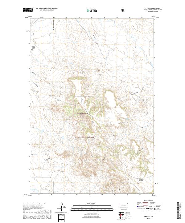
2021 Map of J K Butte
USGS Topo · Published 2021About this map
Custer National Forest lands dominate the center of this Harding County landscape, where the high point at J K Butte overlooks an intricate network of drainage draws. The topography is defined by these seasonal watercourses, including Grandma Schang Draw, Porcupine Draw, and Sagebrush Draw, which carve out the high plains. In the northern reaches, the Sky Ranch For Boys Airport sits along Co HWY 752, representing one of the few developed sites in this corner of South Dakota. To the south, the terrain rises into the West Short Pine Hills, punctuated by landmarks like White Cap. The map captures a high-desert environment where water sources like Rock Pile Spring and Waterhole Cr were historically critical for land use and ranching navigation.
Find a feature on this map
30 named features on this map. Tap any name to fly to it.
Don’t see what you’re looking for? This feature index may not catch every label — zoom into the map to look around manually.
Map Details
Editions of this 2021 J K Butte Map
This is the sole edition of this map. No revisions or reprints were ever made.
Other maps of this area

1935 · Harding
USGS Topo · 1:125,000

1935 · Buffalo
USGS Topo · 1:125,000

1954 · Lemmon
USGS Topo · 1:250,000

1954 · Ekalaka
USGS Topo · 1:250,000

1956 · Ekalaka
USGS Topo · 1:250,000

1957 · Lemmon
USGS Topo · 1:250,000

1958 · Ekalaka
USGS Topo · 1:250,000

1965 · Ekalaka
USGS Topo · 1:250,000

1973 · Hells Canyon
USGS Topo · 1:24,000

1974 · Pine Spring
USGS Topo · 1:24,000