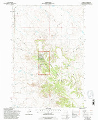
1993 Map of J K Butte
USGS Topo · Published 1996About this map
West Short Pine Hills dominates the topography of this Harding County landscape, where the high-elevation terrain of Custer National Forest provides a sharp contrast to the surrounding draws and drainages. The area is defined by its complex network of seasonal watercourses, including Grandma Schang Draw, Waterhole Creek, and Plum Creek. These geographic features dictate the placement of local homesteads and ranching operations such as the Davis Ranch and Holcomb Ranch, which are situated near the breaks of the hills.
Find a feature on this map
30 named features on this map. Tap any name to fly to it.
Don’t see what you’re looking for? This feature index may not catch every label — zoom into the map to look around manually.
Map Details
Editions of this 1993 J K Butte Map
This is the sole edition of this map. No revisions or reprints were ever made.
Other maps of this area

1935 · Harding
USGS Topo · 1:125,000

1935 · Buffalo
USGS Topo · 1:125,000

1954 · Lemmon
USGS Topo · 1:250,000

1954 · Ekalaka
USGS Topo · 1:250,000

1956 · Ekalaka
USGS Topo · 1:250,000

1957 · Lemmon
USGS Topo · 1:250,000

1958 · Ekalaka
USGS Topo · 1:250,000

1965 · Ekalaka
USGS Topo · 1:250,000

1973 · Hells Canyon
USGS Topo · 1:24,000

1974 · Pine Spring
USGS Topo · 1:24,000