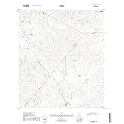
2019 Map of Jack Mountain
USGS Topo · Published 2019About this map
Jack Mtn and the Twin Mountains dominate the rugged landscape northwest of Boerne, where the borders of Kendall, Bandera, Bexar, and Medina counties converge. This region is defined by its complex drainage network, where the headwaters of Balcones Cr and the San Geronimo Cr carve deep into the Texas Hill Country. The presence of the Heimsath Cem and Heimsath Cemetery Lake indicates long-standing family ties to the land, while named water sources like Wolf-Head Spring and Beekman Spring reveal the vital locations of reliable water in this upland terrain. Modern infrastructure is represented by the Freedom Springs Ranch Airport and an evolving network of residential roads like Crown Jewel and Diamond Ridge, showing the area's transition toward rural-residential development. The map also traces significant local landmarks like the Cedar Hill Divide and the historic path of the Chisholm Trl.
Find a feature on this map
93 named features on this map. Tap any name to fly to it.
Don’t see what you’re looking for? This feature index may not catch every label — zoom into the map to look around manually.
Map Details
Editions of this 2019 Jack Mountain Map
This is the sole edition of this map. No revisions or reprints were ever made.
Other maps of this area

1953 · Helotes
USGS Topo · 1:24,000

1953 · Van Raub
USGS Topo · 1:24,000

1954 · San Antonio
USGS Topo · 1:250,000

1956 · Comfort
USGS Topo · 1:62,500

1956 · Medina Lake
USGS Topo · 1:62,500

1957 · Boerne
USGS Topo · 1:62,500

1957 · San Antonio
USGS Topo · 1:250,000

1964 · Boerne
USGS Topo · 1:24,000

1964 · Medina Lake
USGS Topo · 1:24,000
1964 · Ranger Creek
USGS Topo · 1:24,000