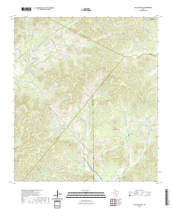
2022 Map of Jack Mountain
USGS Topo · Published 2022About this map
Jack Mountain and the surrounding Hill Country terrain define this landscape at the junction of four Texas counties. The area is characterized by a complex network of springs and intermittent creeks, including Beekman Spring, Wolf Head Spring, and Hamilton Spring, which feed into the San Geronimo Creek and Balcones Creek watersheds. Settlement is sparse, focused on ranching estates and small residential developments like Oak Country and Logan Park. Local history is anchored by family-named sites such as the Heimsath Cemetery and the adjacent Heimsath Cemetery Lake. The presence of the Freedom Springs Ranch Airport suggests the modern evolution of these large landholdings, while topographical landmarks like the Twin Mountains and Three Mountains provide a consistent reference for researchers tracing land boundaries and original homesteads across the Medina, Bandera, Bexar, and Kendall county lines.
Find a feature on this map
95 named features on this map. Tap any name to fly to it.
Don’t see what you’re looking for? This feature index may not catch every label — zoom into the map to look around manually.
Map Details
Editions of this 2022 Jack Mountain Map
This is the sole edition of this map. No revisions or reprints were ever made.
Other maps of this area

1953 · Helotes
USGS Topo · 1:24,000

1953 · Van Raub
USGS Topo · 1:24,000

1954 · San Antonio
USGS Topo · 1:250,000

1956 · Comfort
USGS Topo · 1:62,500

1956 · Medina Lake
USGS Topo · 1:62,500

1957 · Boerne
USGS Topo · 1:62,500

1957 · San Antonio
USGS Topo · 1:250,000

1964 · Boerne
USGS Topo · 1:24,000

1964 · Medina Lake
USGS Topo · 1:24,000
1964 · Ranger Creek
USGS Topo · 1:24,000