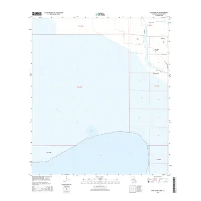
2015 Map of Jacks Point Island
USGS Topo · Published 2015About this map
The expansive waters of White Lake dominate the southern reach of this Vermilion Parish landscape, where the marshy terrain of coastal Louisiana meets a network of vital waterways. Significant maritime infrastructure is centered around the Intracoastal Waterway and the Warren Canal, which navigate through a series of named landforms rising above the wetlands. These features, including Jacks Point Island, Isle Pevley, and Pine Island, reflect the specific geomorphology of the region where land and water are constantly intertwined.
Find a feature on this map
23 named features on this map. Tap any name to fly to it.
Don’t see what you’re looking for? This feature index may not catch every label — zoom into the map to look around manually.
Map Details
Editions of this 2015 Jacks Point Island Map
This is the sole edition of this map. No revisions or reprints were ever made.
Other maps of this area

1932 · Constance Bayou NE
USGS Topo · 1:31,680

1945 · Pecan Island NW
USGS Topo · 1:31,680

1945 · Pecan Island NE
USGS Topo · 1:31,680

1946 · Schooner Bayou SE
USGS Topo · 1:31,680

1946 · Schooner Bayou NE
USGS Topo · 1:31,680

1946 · Schooner Bayou NW
USGS Topo · 1:31,680

1946 · Schooner Bayou SW
USGS Topo · 1:31,680

1951 · Pecan Island
USGS Topo · 1:62,500

1953 · Jacks Point Island
USGS Topo · 1:24,000

1954 · Grand Lake East SE
USGS Topo · 1:31,680