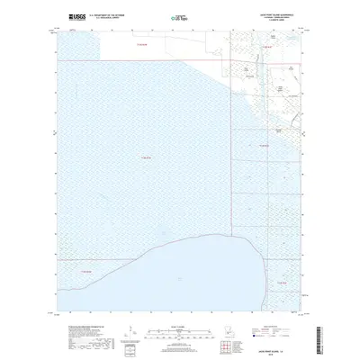
2018 Map of Jacks Point Island
USGS Topo · Published 2018About this map
White Lake dominates the southern landscape of this coastal Vermilion Parish region, where the marshy terrain is punctuated by isolated landforms and a network of artificial and natural waterways. The map illustrates a complex hydraulic environment defined by the Intracoastal Waterway to the north and the Warren Canal cutting through the eastern wetlands. Notable rises in the marsh include Jacks Point Island, Isle Pevley, and Outside Island, which are connected by a sparse system of local roads such as Bull Island Rd and Doc Rd.
Find a feature on this map
21 named features on this map. Tap any name to fly to it.
Don’t see what you’re looking for? This feature index may not catch every label — zoom into the map to look around manually.
Map Details
Editions of this 2018 Jacks Point Island Map
This is the sole edition of this map. No revisions or reprints were ever made.
Other maps of this area

1932 · Constance Bayou NE
USGS Topo · 1:31,680

1945 · Pecan Island NW
USGS Topo · 1:31,680

1945 · Pecan Island NE
USGS Topo · 1:31,680

1946 · Schooner Bayou SE
USGS Topo · 1:31,680

1946 · Schooner Bayou NE
USGS Topo · 1:31,680

1946 · Schooner Bayou NW
USGS Topo · 1:31,680

1946 · Schooner Bayou SW
USGS Topo · 1:31,680

1951 · Pecan Island
USGS Topo · 1:62,500

1953 · Jacks Point Island
USGS Topo · 1:24,000

1954 · Grand Lake East SE
USGS Topo · 1:31,680