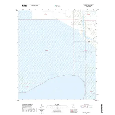
2020 Map of Jacks Point Island
USGS Topo · Published 2020About this map
White Lake and its vast surrounding marshland dominate this 2020 topographic study of coastal Vermilion Parish. The landscape is defined by the tension between land and water, where named high points like Pine Island, Isle Pevley, and Jacks Point Island rise from the wetlands. Human infrastructure is concentrated in the northern and eastern reaches, centered on the Intracoastal Waterway and a network of drainage and transport features like the Warren Canal. This area reflects the modern coastal Louisiana environment, where access is dictated by both watercraft and a handful of local thoroughfares such as Couvillion Rd and Outside Island Rd. The presence of the Gang Pirogue Trail cutting across the marsh highlights the traditional methods of navigation still vital for traversing this intricate coastal shelf.
Find a feature on this map
21 named features on this map. Tap any name to fly to it.
Don’t see what you’re looking for? This feature index may not catch every label — zoom into the map to look around manually.
Map Details
Editions of this 2020 Jacks Point Island Map
This is the sole edition of this map. No revisions or reprints were ever made.
Other maps of this area

1932 · Constance Bayou NE
USGS Topo · 1:31,680

1945 · Pecan Island NW
USGS Topo · 1:31,680

1945 · Pecan Island NE
USGS Topo · 1:31,680

1946 · Schooner Bayou SE
USGS Topo · 1:31,680

1946 · Schooner Bayou NE
USGS Topo · 1:31,680

1946 · Schooner Bayou NW
USGS Topo · 1:31,680

1946 · Schooner Bayou SW
USGS Topo · 1:31,680

1951 · Pecan Island
USGS Topo · 1:62,500

1953 · Jacks Point Island
USGS Topo · 1:24,000

1954 · Grand Lake East SE
USGS Topo · 1:31,680