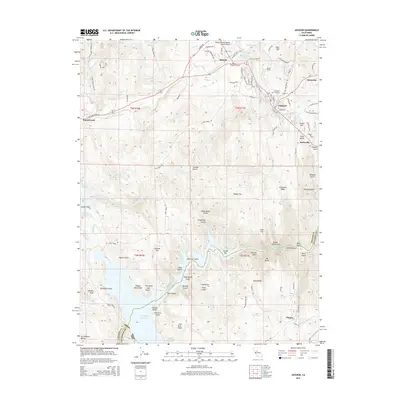
2015 Map of Jackson
USGS Topo · Published 2015About this map
Jackson serves as a central hub in this California gold country landscape, where the legacy of industrial extraction is etched into the terrain. The map documents a dense network of water management features, such as Moore Ditch, Ione Canal, and Kreth Ditch, essential for the region's historical mining and modern utility. Industrial history is further marked by the Massa Tunnel and the prominence of Kennedy Mine Rd, leading toward the historic mining complexes just north of the city center.
Find a feature on this map
117 named features on this map. Tap any name to fly to it.
Don’t see what you’re looking for? This feature index may not catch every label — zoom into the map to look around manually.
Map Details
Editions of this 2015 Jackson Map
This is the sole edition of this map. No revisions or reprints were ever made.
Other maps of this area

1889 · Jackson
USGS Topo · 1:125,000

1892 · Jackson
USGS Topo · 1:125,000

1897 · Jackson
USGS Topo · 1:125,000

1902 · Jackson
USGS Topo · 1:125,000

1941 · Sutter Creek
USGS Topo · 1:62,500

1944 · Valley Springs
USGS Topo · 1:62,500

1944 · Sutter Creek
USGS Topo · 1:62,500

1945 · San Andreas
USGS Topo · 1:62,500

1947 · San Andreas
USGS Topo · 1:62,500

1947 · Sacramento
USGS Topo · 1:250,000