
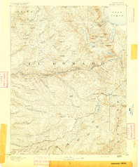
1897 Map of Jackson
USGS Topo · Published 1897About this map
Gold Country settlements and rugged canyon topography define the landscape of Amador and Calaveras counties at the end of the nineteenth century. The Mokelumne River carves a deep path through the center of the sheet, separating towns like Jackson and Mokelumne Hill. The Mother Lode's industrial footprint is visible through numerous named peaks and gulches, including Golden Gate Hill and Chili Gulch, alongside early infrastructure like the Aqueduct near M' Zion.
Find a feature on this map
123 named features on this map. Tap any name to fly to it.
Don’t see what you’re looking for? This feature index may not catch every label — zoom into the map to look around manually.
Map Details
Editions of this 1897 Jackson Map
This is the sole edition of this map. No revisions or reprints were ever made.
Other maps of this area

1889 · Jackson
USGS Topo · 1:125,000

1889 · Pyramid Peak
USGS Topo · 1:125,000

1891 · Sacramento
USGS Topo · 1:125,000

1891 · Big Trees
USGS Topo · 1:125,000

1891 · Placerville
USGS Topo · 1:125,000
1891 · Pyramid Peak
USGS Topo · 1:125,000

1892 · Jackson
USGS Topo · 1:125,000

1892 · Sacramento
USGS Topo · 1:125,000

1892 · Placerville
USGS Topo · 1:125,000

1893 · Placerville
USGS Topo · 1:125,000