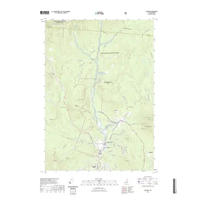
2021 Map of Jackson
USGS Topo · Published 2021About this map
The White Mountain National Forest dominates this mountain landscape, where the town of Jackson serves as a hub for both permanent residents and recreation. Settled along the Ellis River, the village is defined by its proximity to landmark cascades like Jackson Falls and Goodrich Falls. The map details a complex network of seasonal roads and trails, including the Appalachian National Scenic Trail crossing Wildcat Ridge and the designated Wildcat Wild and Scenic River. To the east, the settlement of Dundee sits near the slopes of South Doublehead, while the Black Mountain Cabin provides a remote outpost on the flank of Black Mtn. Local infrastructure, such as Tin Mine Rd and N Hampshire Ridge Rd, highlights the historical transition from early resource extraction to a modern economy centered on the high peaks of the White Mountains.
Find a feature on this map
86 named features on this map. Tap any name to fly to it.
Don’t see what you’re looking for? This feature index may not catch every label — zoom into the map to look around manually.
Map Details
Editions of this 2021 Jackson Map
This is the sole edition of this map. No revisions or reprints were ever made.
Other maps of this area

1893 · Mt. Washington
USGS Topo · 1:62,500

1893 · Gorham
USGS Topo · 1:62,500

1894 · North Conway
USGS Topo · 1:62,500

1895 · Crawford Notch
USGS Topo · 1:62,500

1896 · Mt. Washington
USGS Topo · 1:62,500

1896 · Crawford Notch
USGS Topo · 1:62,500

1896 · North Conway
USGS Topo · 1:62,500

1896 · Gorham
USGS Topo · 1:62,500

1935 · Mt. Washington
USGS Topo · 1:62,500

1937 · Gorham
USGS Topo · 1:48,000