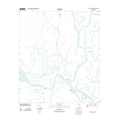
2012 Map of Jackson River
USGS Topo · Published 2012About this map
The Apalachicola River and Jackson River converge within this intricate delta landscape, defining a region where water and marsh dominate. The settlement at Bay City anchors the southeastern corner, while isolated landmarks like Huckleberry Landing and the Box R Ranch suggest the sparse, river-dependent habitation characteristic of this part of Franklin County. The map details a labyrinthine network of sloughs, creeks, and islands, including Forbes Island and Saint Marks Island, which are separated by features like Hidden Johnson Cr and Humphreys Slough. The Intracoastal Waterway cuts a straight path through the natural curves of the river system, passing near Old Womans Bluff. Notable terrain features like The Pinhook and The Haulover indicate historical portage or navigation points within the sprawling wetlands of the Apalachicola Wildlife Area.
Find a feature on this map
54 named features on this map. Tap any name to fly to it.
Don’t see what you’re looking for? This feature index may not catch every label — zoom into the map to look around manually.
Map Details
Editions of this 2012 Jackson River Map
This is the sole edition of this map. No revisions or reprints were ever made.
Other maps of this area

1943 · West Pass
USGS Topo · 1:31,680

1943 · Apalachicola
USGS Topo · 1:31,680

1943 · Indian Pass
USGS Topo · 1:24,000

1943 · Jackson River
USGS Topo · 1:24,000

1944 · White City
USGS Topo · 1:24,000

1944 · Apalachicola
USGS Topo · 1:24,000

1944 · Forbes Island
USGS Topo · 1:24,000

1945 · Forbes Island
USGS Topo · 1:31,680

1945 · Lake Wimico
USGS Topo · 1:31,680

1945 · White City
USGS Topo · 1:31,680