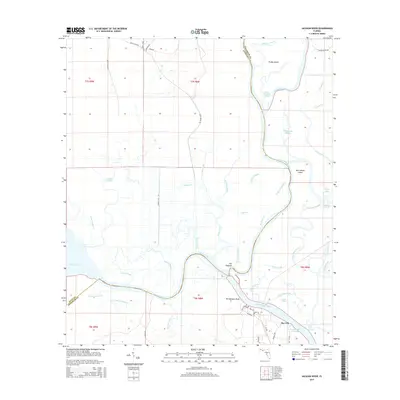
2015 Map of Jackson River
USGS Topo · Published 2015About this map
Bay City serves as the primary hub for this aquatic landscape, situated at the confluence of the Apalachicola River and the Intracoastal Waterway. The terrain is a complex labyrinth of freshwater and brackish channels, featuring prominent landmasses like Forbes Island and Saint Marks Island. The drainage patterns here reveal a sophisticated network of cut-offs and sloughs, including the East River Cut Off and Saul Creek Cut Off, which illustrate the historical and ongoing management of these waterways for navigation and timber.
Find a feature on this map
64 named features on this map. Tap any name to fly to it.
Don’t see what you’re looking for? This feature index may not catch every label — zoom into the map to look around manually.
Map Details
Editions of this 2015 Jackson River Map
This is the sole edition of this map. No revisions or reprints were ever made.
Other maps of this area

1943 · West Pass
USGS Topo · 1:31,680

1943 · Apalachicola
USGS Topo · 1:31,680

1943 · Indian Pass
USGS Topo · 1:24,000

1943 · Jackson River
USGS Topo · 1:24,000

1944 · White City
USGS Topo · 1:24,000

1944 · Apalachicola
USGS Topo · 1:24,000

1944 · Forbes Island
USGS Topo · 1:24,000

1945 · Forbes Island
USGS Topo · 1:31,680

1945 · Lake Wimico
USGS Topo · 1:31,680

1945 · White City
USGS Topo · 1:31,680