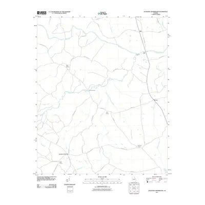
2011 Map of Jacksons Crossroads
USGS Topo · Published 2011About this map
Jacksons Crossroads serves as a central hub in this rural Georgia landscape, where a network of family-named roads like Tom Walton Rd and Pete Johnson Rd connect scattered homesteads and burial grounds. The Broad River defines the northern reaches of the area, crossed by historical points such as Bells Bridge and Kennedys Gate. This topography reveals a deeply rooted agrarian community, where small settlements like Bell and Norman are situated among a complex system of waterways, including Long Creek and Chickasaw Creek.
Find a feature on this map
42 named features on this map. Tap any name to fly to it.
Don’t see what you’re looking for? This feature index may not catch every label — zoom into the map to look around manually.
Map Details
Editions of this 2011 Jacksons Crossroads Map
This is the sole edition of this map. No revisions or reprints were ever made.
Other maps of this area

1893 · Elberton
USGS Topo · 1:125,000

1906 · Crawfordville
USGS Topo · 1:125,000

1953 · Athens
USGS Topo · 1:250,000

1954 · Greenville
USGS Topo · 1:250,000

1955 · Tignall
USGS Topo · 1:24,000

1955 · Broad
USGS Topo · 1:24,000

1958 · Greenville
USGS Topo · 1:250,000

1958 · Athens
USGS Topo · 1:250,000

1958 · Elberton
USGS Topo · 1:62,500

1959 · Athens
USGS Topo · 1:250,000