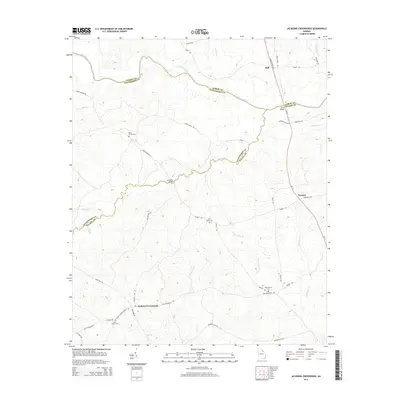
2014 Map of Jacksons Crossroads
USGS Topo · Published 2014About this map
Jacksons Crossroads serves as a central point in this rural Georgia landscape, situated where several local routes like Mallorysville Rd and Collins Rd converge. The terrain is defined by its position at the intersection of Elbert, Oglethorpe, and Wilkes Counties, with the Broad River carving a winding boundary through the northern section. This area is heavily dotted with family and church-related history, evidenced by Clarks Station Cem near the Clark Station Church Rd and Saint Johns Cem further north. Historical river crossings are preserved in the naming of Bells Bridge and Gunnells Bridge, the latter connecting roads over Goosepond Cr. Small settlement nodes like Bell and Norman along Ga-17 illustrate the traditional rural development pattern typical of the Georgia Piedmont, where communities grew around key crossroads and family cemeteries.
Find a feature on this map
48 named features on this map. Tap any name to fly to it.
Don’t see what you’re looking for? This feature index may not catch every label — zoom into the map to look around manually.
Map Details
Editions of this 2014 Jacksons Crossroads Map
This is the sole edition of this map. No revisions or reprints were ever made.
Other maps of this area

1893 · Elberton
USGS Topo · 1:125,000

1906 · Crawfordville
USGS Topo · 1:125,000

1953 · Athens
USGS Topo · 1:250,000

1954 · Greenville
USGS Topo · 1:250,000

1955 · Tignall
USGS Topo · 1:24,000

1955 · Broad
USGS Topo · 1:24,000

1958 · Greenville
USGS Topo · 1:250,000

1958 · Athens
USGS Topo · 1:250,000

1958 · Elberton
USGS Topo · 1:62,500

1959 · Athens
USGS Topo · 1:250,000