2024 Map of Jacksonville Beach
USGS Topo · Published 2024About this map
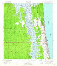
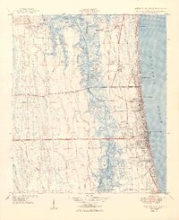
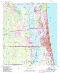
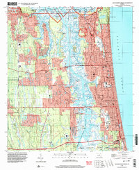
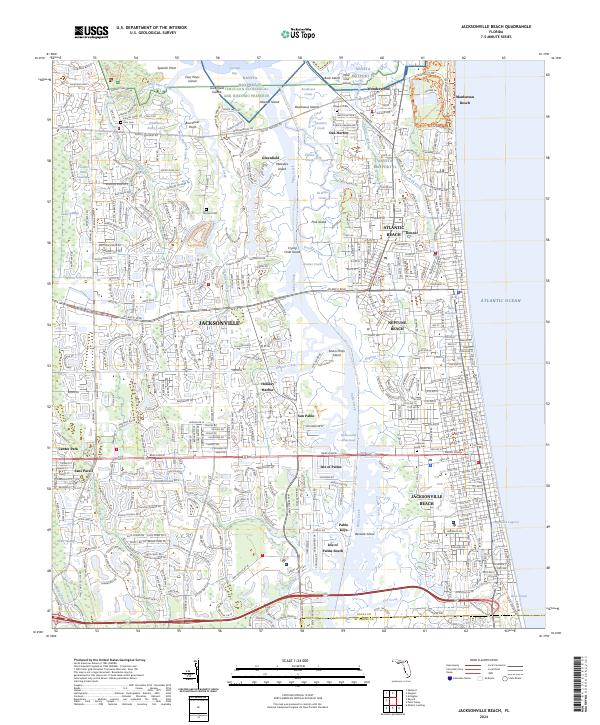
Navsta Mayport Fl anchors the northern coastline where the Atlantic meets the dense network of islands and tidal creeks east of Jacksonville. This coastal landscape is defined by the Intracoastal Waterway, which carves through the wetlands separating the mainland from the beach communities of Atlantic Beach, Neptune Beach, and Jacksonville Beach. Further inland, family heritage is preserved at small burial sites such as Rain Cem and Tillotson Cem, while the sprawling Timucuan Ecological and Historic Preserve protects the wetlands around Chicopit Bay and Spanish Point. The map details the transition from established suburban neighborhoods like Center Park to the ecological fringes of Possum Head Swamp and Cedar Swamp, illustrating the tension between residential development and the natural marsh systems that characterize the St. Johns River delta region.
Find a feature on this map
76 named features on this map. Tap any name to fly to it.
Don’t see what you’re looking for? This feature index may not catch every label — zoom into the map to look around manually.
Map Details
Editions of this 2024 Jacksonville Beach Map
This is the sole edition of this map. No revisions or reprints were ever made.
Historical Maps of Jacksonville Through Time
5 maps found