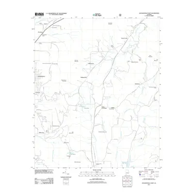
2011 Map of Jacksonville East
USGS Topo · Published 2011About this map
Choccolocco Mountain and the surrounding ridges of the Blue Ridge foothills dominate this landscape east of Jacksonville. The area is characterized by a series of prominent peaks and gaps, including Chimney Peak with its Chimney Peak Lookout Tower and the passage at Rabbittown Gap. Smaller settlements and crossroads like Rabbittown, Hallingworth, and Holley Crossroads are linked by a network of rural roads that navigate the narrow valleys formed by Cottaquilla Creek and Nances Creek.
Find a feature on this map
90 named features on this map. Tap any name to fly to it.
Don’t see what you’re looking for? This feature index may not catch every label — zoom into the map to look around manually.
Map Details
Editions of this 2011 Jacksonville East Map
This is the sole edition of this map. No revisions or reprints were ever made.
Other maps of this area

1900 · Anniston
USGS Topo · 1:125,000

1947 · Anniston
USGS Topo · 1:24,000

1947 · Colvin Gap
USGS Topo · 1:24,000

1947 · Jacksonville
USGS Topo · 1:24,000

1947 · Jacksonville
USGS Topo · 1:62,500

1950 · Anniston
USGS Topo · 1:62,500

1953 · Atlanta
USGS Topo · 1:250,000

1954 · Choccolocco
USGS Topo · 1:24,000

1956 · Anniston
USGS Topo · 1:24,000
1956 · Jacksonville
USGS Topo · 1:24,000